See More Than Maps Alone
Maps provide valuable spatial information, but they don't always show what's happening on the ground. Street-level imagery adds the visual context needed to validate assets, assess infrastructure, and better understand the environment.
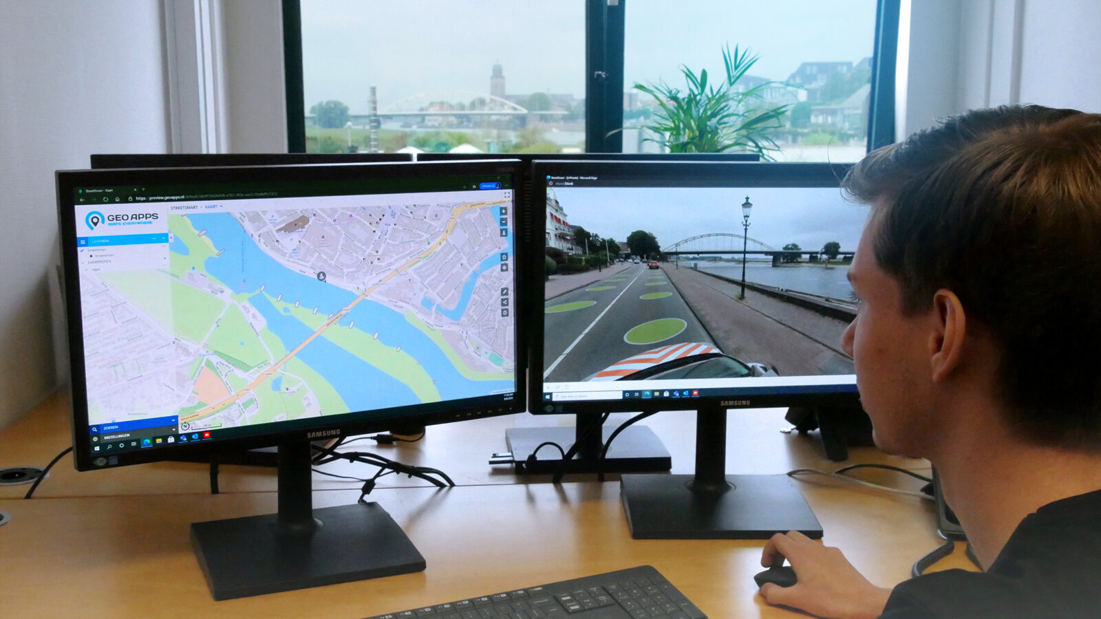
With the integration of StreetSmart by Cyclomedia, GeoApps allows users to access detailed street imagery directly from the GIS viewer. Instead of switching between multiple applications, teams can work with maps, street-level imagery, and geospatial datasets in one environment.
Benefits include:
Faster location verification
Better understanding of real-world conditions
Improved data validation
More informed decision-making
By bringing maps and imagery together, GeoApps helps organizations gain a complete picture of the areas they manage.
Accelerate Inspections and Asset Management
Field inspections often require both geographic data and visual confirmation. StreetSmart simplifies this process by connecting street-level imagery directly to map layers and assets.
Users can quickly investigate locations, review infrastructure, and assess conditions without immediately visiting the site. In addition, StreetSmart offers measurement capabilities that support planning, maintenance, and operational workflows.
Use StreetSmart to:
Inspect infrastructure remotely
Measure distances and object dimensions
Support maintenance planning
Reduce unnecessary field visits
Improve operational efficiency
As a result, organizations can make faster decisions while reducing time spent in the field.
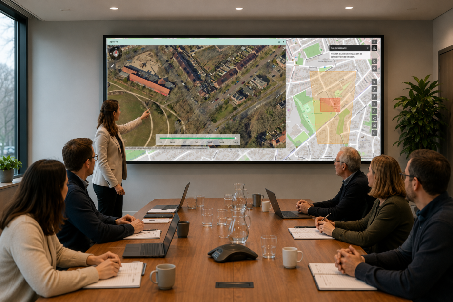
Bring Street-Level and Aerial Imagery Together
StreetSmart is part of GeoApps' vision to bring multiple spatial information sources into a single GIS environment.
In addition to street-level imagery, GeoApps supports Geo Oblique imagery, providing detailed aerial photographs captured from multiple viewing angles. This enables users to inspect buildings, infrastructure, and public spaces from perspectives that traditional top-down imagery cannot provide.
Combine:
StreetSmart street-level imagery
Geo Oblique aerial photography
GIS layers and geodata
Asset and infrastructure information
External datasets and integrations
This unified approach allows users to move seamlessly between map, street-level, and aerial views while maintaining full spatial context.
Make Better Decisions with Complete Spatial Context
When maps, street-level imagery, and aerial photography are available within one platform, organizations can work more efficiently and confidently.
Whether you're managing infrastructure, validating assets, planning projects, or performing inspections, GeoApps helps bring all relevant spatial information together in a single workflow.
By combining GIS data with StreetSmart and Geo Oblique imagery, teams gain deeper insight, improve collaboration, and make better-informed decisions.
Discover how GeoApps combines GIS data, street-level imagery, and aerial photography in one platform for inspection, analysis, and asset management.


