Skip to main contentSkip to navigation
ExploreJobsAbout usContact
Log in
MapGear Logo
JobsNewsAbout MapGear
Log inContact
MapGear, known through GeoAppsGeoApps
GeoApps Logo
Apps
Solutions
Platform
About us
Get advice
Hero background
  1. Home
  2. Solutions
  3. Real Estate & Asset Management

Optimize real estate operations and decisions

Put your real estate portfolio on the map with GeoApps. In practice we often partner with Assetmaps: you get the map and a GIS partner, so you do not have to get into the weeds of configuration and GIS work.

Who uses GeoApps for Real Estate & Asset Management?

Discover how GeoApps helps organizations optimize their operations

Municipalities

Municipalities

Municipalities

Municipal asset management and real estate portfolio optimization.

GeoApps
Housing Corporations

Housing Corporations

Housing Corporations

Property management and tenant services for housing associations.

GeoApps
Property Developers

Property Developers

Property Developers

Real estate development planning and project management tools.

GeoApps
Provinces

Provinces

Provinces

Regional real estate and infrastructure management with geospatial insights.

GeoApps

Trusted by leading real estate organizations

  • Woonbedrijf
  • Q-Estate
  • Gemeente Rotterdam
  • Arcadis
  • Provincie Overijssel
  • Rabobank
  • Gemeente Utrecht
  • Stantec
  • Gemeente Enschede
  • Provincie Utrecht
  • Assetmaps
  • Gemeente Hengelo
  • Arup
  • Gemeente Apeldoorn
  • Provincie Gelderland
  • Deloitte
  • Kragten
  • Gemeente Maastricht
  • Gemeente Ede
  • Provincie Noord-Holland
  • Tauw
  • Gemeente Epe
  • Roelofs
  • Gemeente Gennep
  • Provincie Flevoland
  • Roelofs Lemelerveld
  • Woonbedrijf
  • Q-Estate
  • Gemeente Rotterdam
  • Arcadis
  • Provincie Overijssel
  • Rabobank
  • Gemeente Utrecht
  • Stantec
  • Gemeente Enschede
  • Provincie Utrecht
  • Assetmaps
  • Gemeente Hengelo
  • Arup
  • Gemeente Apeldoorn
  • Provincie Gelderland
  • Deloitte
  • Kragten
  • Gemeente Maastricht
  • Gemeente Ede
  • Provincie Noord-Holland
  • Tauw
  • Gemeente Epe
  • Roelofs
  • Gemeente Gennep
  • Provincie Flevoland
  • Roelofs Lemelerveld
  • Gemeente Maasgouw
  • Dekker Groep
  • Gemeente Wierden
  • Provincie Groningen
  • Thius
  • Gemeente Zundert
  • Tijdlab
  • Gemeente Haarlemmermeer
  • Provincie Drenthe
  • Mateboer
  • Gemeente Groningen
  • Aveco de Bondt
  • Gemeente Deventer
  • Riese & Geurts
  • Gemeente Dordrecht
  • OMWB
  • Gemeente Rijswijk
  • TTE
  • Gemeente Leiden
  • KWR
  • Gemeente Sittard-Geleen
  • Lycens
  • Westerkwartier
  • Nordend
  • Royal HaskoningDHV
  • Gemeente Maasgouw
  • Dekker Groep
  • Gemeente Wierden
  • Provincie Groningen
  • Thius
  • Gemeente Zundert
  • Tijdlab
  • Gemeente Haarlemmermeer
  • Provincie Drenthe
  • Mateboer
  • Gemeente Groningen
  • Aveco de Bondt
  • Gemeente Deventer
  • Riese & Geurts
  • Gemeente Dordrecht
  • OMWB
  • Gemeente Rijswijk
  • TTE
  • Gemeente Leiden
  • KWR
  • Gemeente Sittard-Geleen
  • Lycens
  • Westerkwartier
  • Nordend
  • Royal HaskoningDHV

Key benefits for real estate management

More efficient management

Optimize real estate management with digital tools and real-time insight into your real estate portfolio.

Better decision-making

Make data-driven choices based on analyses, maps, and clear reports.
Lower costs

Reduce maintenance costs through preventive management and smart planning.

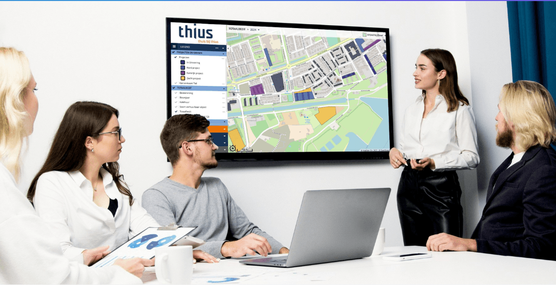
Dashboard for your real estate

Real-time insight into, for example, maintenance, occupancy, and performance of your real estate. Plan preventive maintenance, manage costs, and generate automatic reports and analyses.
    Dashboard for your real estate

    What does GeoApps deliver?

    Portfolio overview

    Maintenance and planning

    Livability and sustainability

    Risk and compliance insight

    "With GeoApps, we have our entire housing stock and the corresponding data available in one environment. This gives us insight into maintenance, livability, and sustainability at a glance. This makes our real estate planning much faster and better substantiated."
    Peter van Essen, New Construction Manager, Thius

    Related Apps

    Discover our apps that perfectly complement this solution

    Viewer

    Interactive map viewer for spatial data

    Dashboard

    Data visualization and analysis dashboard

    ESG-Maps

    Make sustainability data visible with interactive ESG-mapping

    MapTalk

    Public participation platform

    Optimize your real estate management

    Bring all your real estate data, planning, and analyses together in one environment with GeoApps. Discover how you can make faster and smarter decisions.

    Contact Us
    GeoApps Viewer
    Gasfabriek project
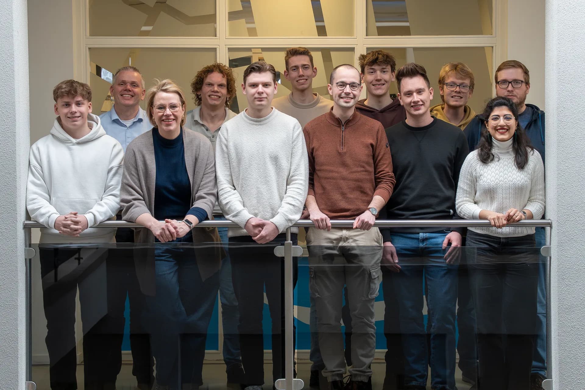
    MapGear team office

    Frequently asked questions

    Answers about GeoApps for real estate management and asset management.

    What does GeoApps offer for real estate management?
    GeoApps is a GIS platform for managing your property portfolio on the map: from ownership and maintenance to energy performance and liveability. You get one up-to-date spatial overview of all your assets.
    What real estate data can we connect?
    You can connect sources such as BAG, cadastral data, energy labels, maintenance records, rental data and your own asset databases. Import portfolios, maintenance plans and investment scenarios; data is linked to locations automatically.
    How does portfolio management work in GeoApps?
    Bring all your properties together in one dashboard and map. Analyse maintenance, liveability, sustainability and investments with current insights so you quickly see where attention or opportunities lie.
    Can we plan maintenance with GeoApps?
    Yes. Visualise maintenance status and multi-year plans on the map, prioritise work and keep a clear historical view so budgets are spent where they matter most.
    How does Assetmaps fit in?
    Assetmaps is one of our partners for real-time building data and indoor mapping. Together with GeoApps you combine portfolio data from your systems with detailed building information in the same viewer.
    What does implementation involve?
    A typical implementation covers setup, data connections, roles and permissions, training and handover. Depending on scope this often takes a few weeks. We are happy to start with a demo or intake.
    GeoApps Logo

    GeoApps is the leading software platform for GIS applications and spatial data, enabling organizations to make data-driven decisions.

    Solutions

    • Urban Planning
    • Infrastructure
    • Real Estate
    • Environment & Climate
    • Energy Transition
    • Safety & Risk
    • GIS & cartography

    Products

    • GeoApps
    • Solutions
    • ESG-Maps
    • MapServices
    • TouchTable
    • Consultation
    • Platform

    Apps

    • Viewer
    • Dashboard
    • Fieldwork
    • MapTour
    • MapTalk
    • Custom
    • QGIS plugin

    For whom?

    • Municipalities
    • Provinces
    • Environmental Services
    • Engineering
    • Contractors
    • Safety Regions
    • Water authorities

    Platform

    • Integrations
    • Documentation
    • GIS Lexicon
    • System Status
    • Changelog
    • Support
    • Subscriptions

    Company

    • About Us
    • Careers
    • Contact
    • Partners
    • News & Blog
    • Events
    • Case studies

    Stay up-to-date

    Subscribe to our newsletter to get the latest updates on our products and services. You can unsubscribe at any time.

    Keep an eye on our socials too

    Stay connected with us through our social media channels and get the latest updates on our products and services.

    Quality & trust

    MapGear is ISO 9001 and ISO 27001 certified and meets the highest quality and security standards for our products and services.

    ISO 9001 Certificering
    ISO 27001 Certificering
    QGIS Membership 2026
    © 2026 MapGear B.V. All rights reserved.
    Terms & conditionsPrivacy PolicySustainability statement