Skip to main contentSkip to navigation
ExploreJobsAbout usContact
Log in
MapGear Logo
JobsNewsAbout MapGear
Log inContact
MapGear, known through GeoAppsGeoApps
GeoApps Logo
Apps
Solutions
Platform
About us
Get advice
GeoApps Logo

GeoApps is the leading software platform for GIS applications and spatial data, enabling organizations to make data-driven decisions.

Solutions

  • Urban Planning
  • Infrastructure
  • Real Estate
  • Environment & Climate
  • Energy Transition
  • Safety & Risk
  • GIS & cartography

Products

  • GeoApps
  • Solutions
  • ESG-Maps
  • MapServices
  • TouchTable
  • Consultation
  • Platform

Apps

  • Viewer
  • Dashboard
  • Fieldwork
  • MapTour
  • MapTalk
  • Custom
  • QGIS plugin

For whom?

  • Municipalities
  • Provinces
  • Environmental Services
  • Engineering
  • Contractors
  • Safety Regions
  • Water authorities

Platform

  • Integrations
  • Documentation
  • GIS Lexicon
  • System Status
  • Changelog
  • Support
  • Subscriptions

Company

  • About Us
  • Careers
  • Contact
  • Partners
  • News & Blog
  • Events
  • Case studies

Stay up-to-date

Subscribe to our newsletter to get the latest updates on our products and services. You can unsubscribe at any time.

Keep an eye on our socials too

Stay connected with us through our social media channels and get the latest updates on our products and services.

Quality & trust

MapGear is ISO 9001 and ISO 27001 certified and meets the highest quality and security standards for our products and services.

ISO 9001 Certificering
ISO 27001 Certificering
QGIS Membership 2026
© 2026 MapGear B.V. All rights reserved.
Terms & conditionsPrivacy PolicySustainability statement
Interactive GeoApps Demos and Walkthroughs for Users | GeoApps Blog
Featured image for New in GeoApps: Interactive Demos and Walkthroughs
View All Posts
📸 Featured
Insights

New in GeoApps: Interactive Demos and Walkthroughs

Discover how interactive demos and walkthroughs guide users directly within GeoApps, helping them learn workflows faster, discover more functionality and work more independently.

July 17, 2026
GeoApps Team
4 min

Find Your Way Around GeoApps More Quickly

The first time someone uses a GIS environment, several practical questions may arise. Which layers should they open? How do filters and search functions work? Where can they find object information, dashboards or analyses?

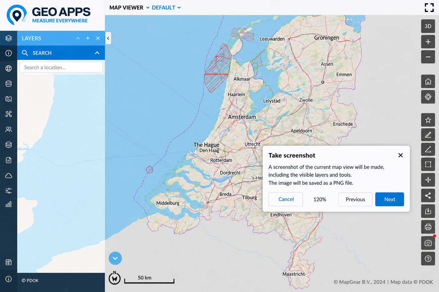
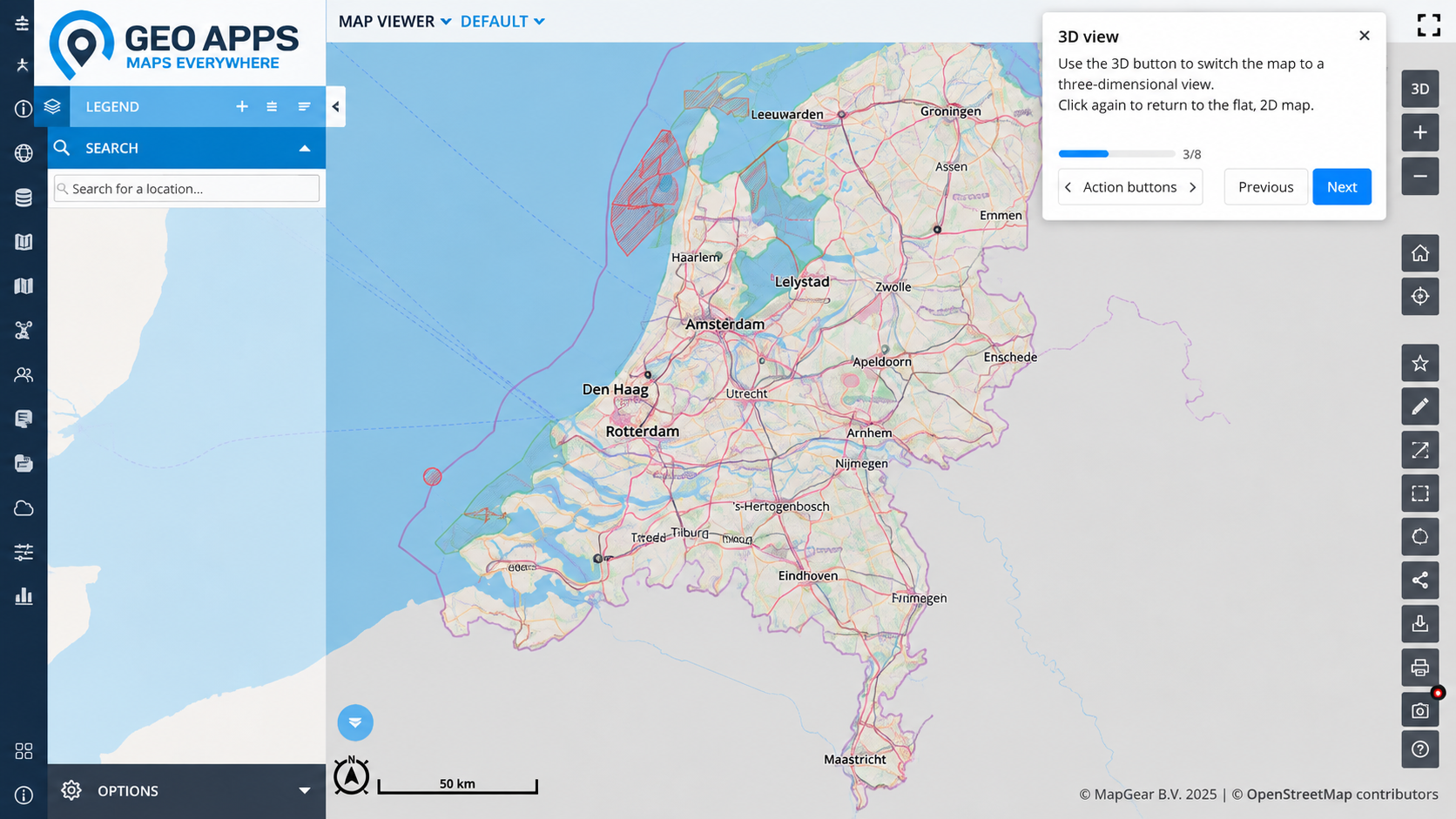
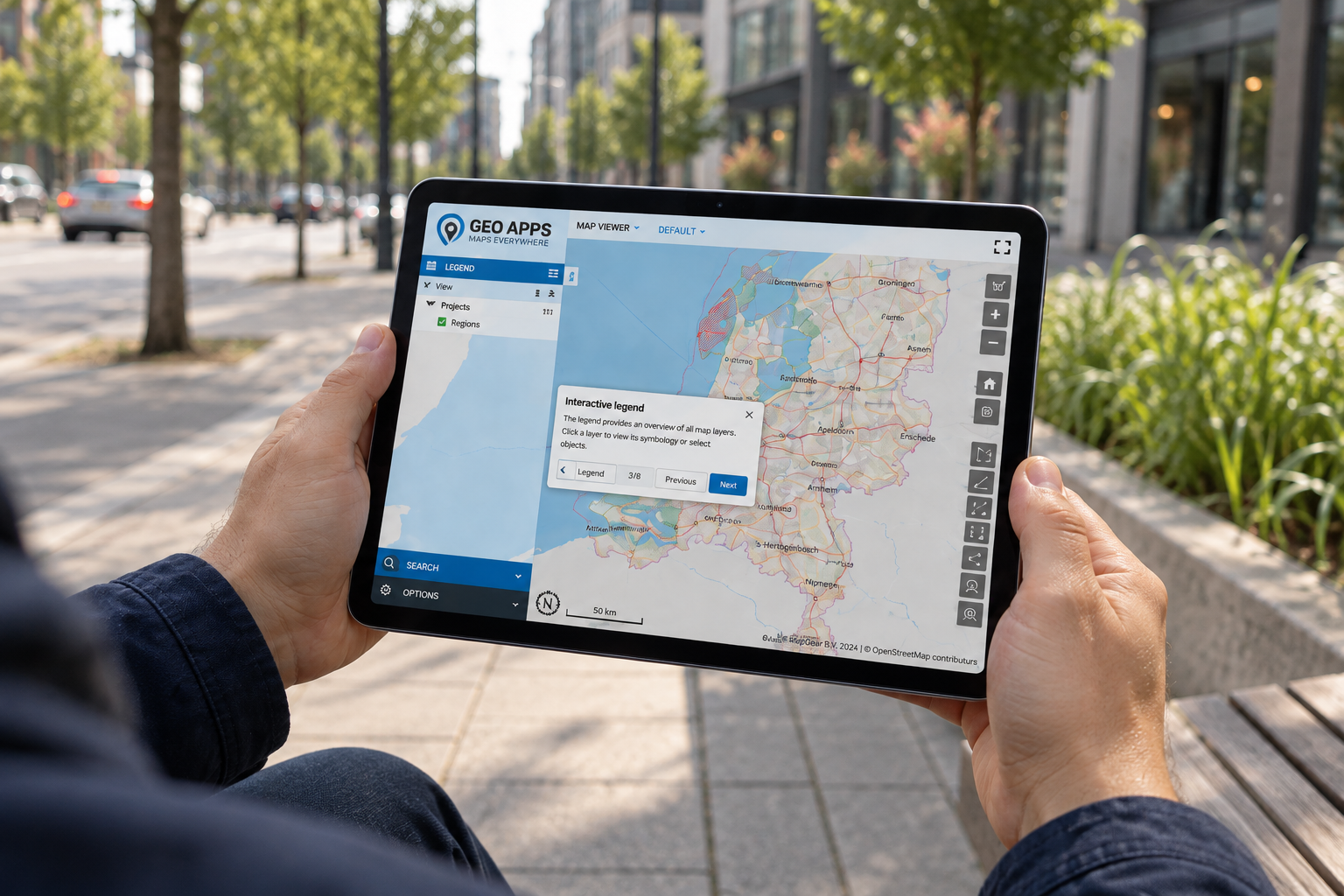
Interactive walkthroughs lead users through the most important functions in a clear sequence. Instructions appear directly in the GeoApps environment, allowing users to learn while working rather than switching between the platform and a separate manual.

Walkthroughs can help users:

  • find relevant map layers;

  • explore datasets and object information;

  • apply filters and search functions;

  • use dashboards and analyses;

  • complete common workflows;

  • share results with colleagues.

Because the guidance is connected to the action taking place, users can apply each instruction immediately. This supports faster onboarding and helps new users become independent sooner.

Provide Guidance Inside the Workflow

Traditional documentation remains useful, but it does not always appear at the moment someone needs help. Users must first locate the correct instructions, understand them and then reproduce the steps inside the application.

An interactive walkthrough brings the explanation to the user instead. Prompts and next steps appear within GeoApps and guide them through a task or feature in context. This approach can support the first introduction to the platform, the launch of new functionality or the explanation of an organisation-specific workflow.

Users do not need to memorise the complete process in advance. They can learn while carrying out the task, making the guidance more practical and easier to apply.

🖼️
Image not available
This image could not be loaded

Help Users Discover More With Fewer Support Questions

A portion of the functionality within extensive software platforms often remains unused. This is not necessarily because those functions lack value, but because users may not know they exist or understand how they fit into their work.

Interactive demos make those capabilities easier to discover. Organisations can guide users through activities such as combining map layers, reviewing object information, completing an analysis or working with a new dashboard. Users can explore these features at their own pace and immediately see how they support a practical workflow.

Walkthroughs also provide a first layer of assistance for recurring questions. As users become more capable of completing basic tasks independently, GIS administrators and application managers can spend less time repeating the same explanations and more time supporting complex or organisation-specific needs. GeoApps highlights faster onboarding, greater confidence and broader adoption as key benefits of this in-app guidance.

Configure Walkthroughs for Every App in GeoApps Manage

Every organisation uses GeoApps differently. One app may focus on asset management, while another supports policy analysis, fieldwork or project communication. The guidance should therefore reflect the functions, users and workflows of each specific application.

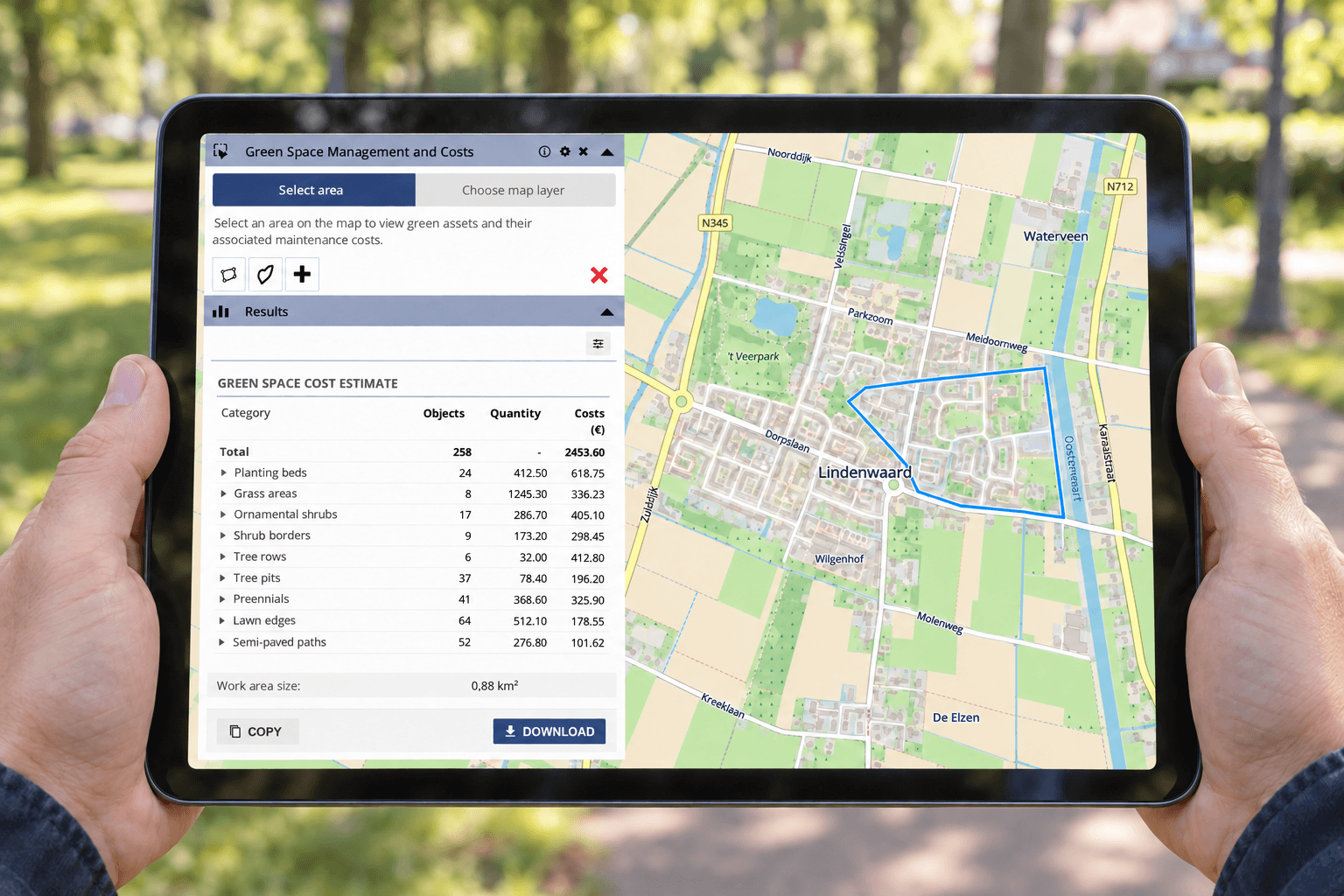
Walkthroughs can be configured in GeoApps Manage for any app within your GeoApps environment. This allows administrators to create app-specific guidance rather than relying on one generic tour for the entire platform. Users receive instructions that match the application they are working in and the tasks they are expected to complete.

A walkthrough can support new-user onboarding, explain a recently introduced function or guide colleagues through an organisation-specific process. By configuring the guidance per app, organisations can offer more relevant support and create a more consistent user experience across teams and departments.

🖼️
Image not available
This image could not be loaded

Make GeoApps Easier to Use Across Your Organisation

A powerful GIS environment should not only provide extensive functionality. It should also help users understand how to apply that functionality within their work.

Interactive demos and walkthroughs bring guidance directly into GeoApps. New users can get started more quickly, experienced users can discover additional possibilities and organisations can support adoption without relying entirely on repeated training or individual assistance.

Would you like to see how interactive walkthroughs can guide users within your GeoApps applications?

Request a no-obligation demonstration and discover how GeoApps supports faster onboarding, independent use and wider adoption across your organisation.

View All PostsGet a Demo

Related Posts

You might also like

On-Prem vs. SaaS: Where Should GIS Live in 2026?

On-Prem vs. SaaS: Where Should GIS Live in 2026?

Many organisations are weighing on-premises GIS against SaaS. Discover why a hybrid architecture often provides the best balance between control, flexibility and manageable technical operations.

July 16, 2026Read more
Offline GIS with GeoApps: Keep Working Without an Internet Connection

Offline GIS with GeoApps: Keep Working Without an Internet Connection

Internet coverage isn't always available where work happens. With GeoApps' new offline functionality, users can continue working with maps and spatial data anywhere, even without a network connection.

July 2, 2026Read more
From Drawing to Complete Object Registration with Smart Forms

From Drawing to Complete Object Registration with Smart Forms

Discover how GeoApps brings geometry and attribute information together. Smart Forms and conditional fields help users register objects faster, more consistently and with only the fields relevant to each situation.

June 30, 2026Read more
Get Control of Your Geodata with the New Data Management Features in GeoApps

Get Control of Your Geodata with the New Data Management Features in GeoApps

Managing geodata does not have to be a daily search. With the new Data Management features in GeoApps, you gain immediate structure, clarity, and control over your spatial projects.

November 29, 2025Read more
GeoApps Release 29.1: New Features for Apps, Management and Analytics

GeoApps Release 29.1: New Features for Apps, Management and Analytics

Discover the latest improvements in GeoApps 29.1, including MapTour support in the Editor, Multi-Edit functionality, management environment enhancements, and expanded analytics capabilities.

March 7, 2023Read more
StreetSmart Street Imagery in GeoApps: Maps and Street-Level Views in One GIS Viewer

StreetSmart Street Imagery in GeoApps: Maps and Street-Level Views in One GIS Viewer

Combine StreetSmart street-level imagery, maps, and aerial photography in one GIS viewer. Improve inspections, analysis, and asset management with GeoApps.

September 9, 2020Read more

Ready to Get Started?

Join thousands of users who are already using GeoApps to transform their spatial data workflows.

Get a Demo
GeoApps Viewer
Gasfabriek project
MapGear team office
Last Updated: July 27, 2026