

New in GeoApps: BRK, WOZ, KvK and the QGIS Plugin
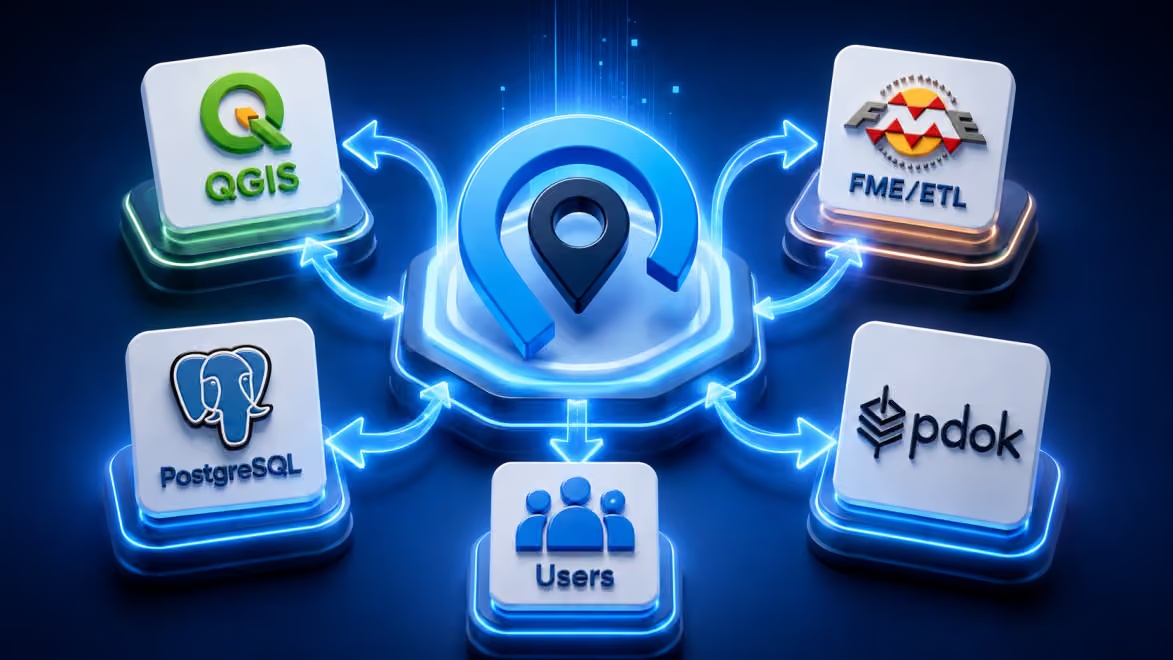
GeoApps continues to expand its integration landscape. New connections for BRK, WOZ and KvK make official Dutch source information more accessible within maps, analyses and everyday organisational workflows. The relatively new QGIS Plugin also creates a more direct connection between specialist desktop GIS and GeoApps. These additions follow a practical principle: data should not only be technically available. It should also be easy to find, understand and use within the processes where employees need it.
Organisations can therefore reduce manual exports, avoid unnecessary copies of datasets and bring information from different systems together within targeted spatial applications. The new integrations form part of a broader approach in which GeoApps connects with existing databases, GIS services, APIs and business systems rather than operating as an isolated platform.
Make BRK data accessible within GeoApps
The Dutch Key Register of Cadastre, known as BRK, contains information about cadastral parcels and registered property rights. This information supports processes involving property, spatial development, permits, asset management and planning. Through the BRK integration, cadastral information can be made available within GeoApps and combined with internal project data, area boundaries and other spatial layers.
Users can view parcels within their wider geographic context and access relevant source information without repeatedly downloading and processing separate files. The official register remains the authoritative source, while GeoApps makes the information accessible within practical map applications and organisational workflows.
Request and analyse WOZ information at scale
WOZ data supports property analysis, taxation, monitoring and several policy and management processes. Collecting information for larger numbers of properties can, however, involve substantial manual work. The WOZ Mass Query integration connects GeoApps with the official Dutch Kadaster service for requesting WOZ information in bulk. Results can be brought directly into maps, layers and spatial workflows instead of being processed repeatedly through separate spreadsheets and exports.
This makes it easier to support:
property and area-based analyses;
periodic checks and monitoring;
tax and management processes;
combinations with buildings, neighbourhoods and other spatial datasets;
consistent use of source information across applications.
The value lies not only in retrieving the information, but in making it immediately usable within spatial analysis and decision-making.
Connect KvK information to locations and areas
Business information becomes more useful when organisations can see where companies and economic activities are located. The KvK integration makes it possible to connect information from the Dutch Chamber of Commerce with spatial context inside GeoApps. This can support economic analyses, business-area inventories, targeted communication and policy questions involving commercial districts or city centres.
KvK information may be combined with:
addresses and buildings;
business parks;
planning areas and boundaries;
mobility and accessibility information;
environmental or sustainability data;
internal project and research information.
Administrative company information therefore becomes part of a spatial analysis instead of remaining in a separate list without geographic context. The exact information and options depend on the connected KvK service and the requirements of the application.
Work more directly between QGIS and GeoApps
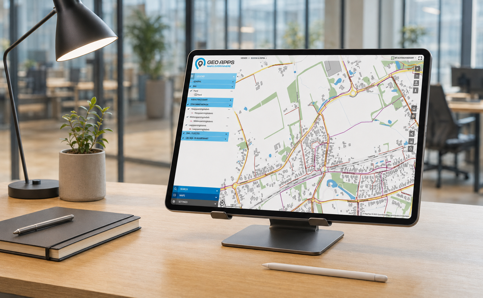
QGIS remains an important working environment for GIS professionals carrying out data management, cartography and specialist spatial analysis. GeoApps has a different role. It makes spatial information and results accessible to a broader group of users through web-based viewers, dashboards and process-oriented applications.
The QGIS Plugin connects these environments more directly. Users can load GeoApps data into QGIS and upload data from QGIS to GeoApps projects and datasets. The plugin is included across GeoApps subscriptions.
This helps GIS professionals:
access GeoApps data from their familiar QGIS environment;
publish datasets from QGIS to GeoApps;
reduce manual downloading and uploading;
exchange data more efficiently between desktop and Web GIS;
make analyses and map layers available to other users more quickly.
QGIS and GeoApps do not need to replace one another. QGIS supports specialist GIS work, while GeoApps makes the results available through accessible organisational applications.
New connections within a broader integration approach
BRK, WOZ, KvK and the QGIS Plugin are concrete additions, but they do not stand alone. Organisations usually work with several types of systems. Geometry may be stored in a spatial database, map layers may be published through web services and additional attributes may come from administrative or specialist systems.
GeoApps brings this information together in applications tailored to specific users and objectives. The underlying systems can retain their established roles while employees work with relevant information from one accessible map environment.
Continue using existing GIS services and databases
GeoApps supports common methods for accessing and publishing spatial information. Standards such as WMS, WMTS and WFS allow organisations to use maps and object information from their existing GIS infrastructure. Direct database connections also make it possible to work with established spatial data sources without creating a separate copy for every application. GeoApps supports these common service standards and offers direct integration with PostgreSQL and PostGIS.
This helps organisations:
maintain one authoritative data source;
reduce duplicated datasets;
improve data currency and consistency;
build on existing infrastructure investments;
make the same information available across several applications.
Add information through APIs and external systems
Not all relevant information is stored in a GIS database. Statuses, documents, measurements and administrative attributes may come from other systems. APIs allow this information to be retrieved, linked or processed without moving every dataset into one new database.
The GeoApps REST API supports programmatic access to projects and enables developers to create custom connections with external applications and services. GeoApps can therefore act as the spatial access point to information from several systems while each source continues to manage its own specialist data.
Give every system a clear role
Successful integrations require clear agreements about ownership and management.
For each type of information, organisations should determine:
which system is the authoritative source;
where geometry is maintained;
where administrative attributes are updated;
which users may view or edit information;
how frequently information is refreshed;
what happens when a connected source is unavailable.
GeoApps does not always need to become the primary storage environment. It can function as an accessible application layer above existing sources, allowing users to view, combine, analyse and apply information without working directly inside every underlying system.
Reduce manual exports and duplicate management
When systems are not connected, employees often export information into files or spreadsheets and import it again elsewhere. This quickly creates several versions of the same dataset. One employee may be working with an older export while the central source has already been updated.
A well-designed integration limits these unnecessary steps. The source remains authoritative, while current information becomes available through GeoApps.
This can deliver:
fewer manual exports and uploads;
less risk of outdated files;
more current information for users;
clearer data ownership;
better cooperation between GIS, IT and operational teams;
faster availability of information within applications.
The BRK, WOZ and KvK integrations demonstrate how official and administrative information can become part of spatial applications. The QGIS Plugin simultaneously improves collaboration between specialist desktop GIS and accessible web applications.
The value of an integration goes beyond the technical connection itself. Its real impact appears when data becomes directly usable for analysis, policy, management, fieldwork and decision-making.
Would you like to explore how these new integrations or other GeoApps connections could support your organisation?
View the complete integration overview or schedule an introductory conversation about your data sources, systems and workflows.


