
GeoApps continues to evolve as a powerful platform for building, managing, and sharing geospatial applications. With Release 29.1, the focus is on expanding application capabilities, streamlining management workflows, and improving analytical functionality for users working with geographic data.
These updates help organizations work more efficiently, manage data at scale, and gain deeper insights from their GIS environments.
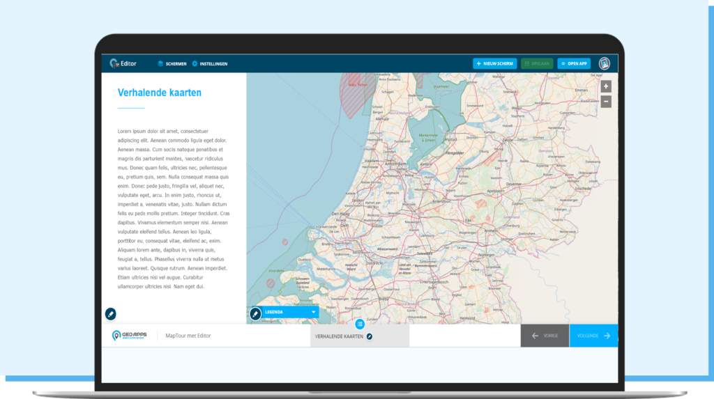
MapTour Now Available in the Editor
One of the most significant additions in GeoApps 29.1 is full support for MapTour within the GeoApps Editor.
Organizations can now create and manage interactive story maps directly from the Editor, combining locations, images, text, and geographic information into engaging user experiences.
Benefits include:
Build interactive map-based stories with ease
Manage MapTours centrally through the GeoApps Editor
Improve communication around projects and locations
Support public engagement and participation initiatives
MapTour makes it easier to transform complex geographic information into accessible and engaging content.
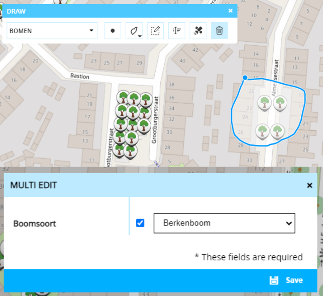
Faster Data Management with Multi-Edit
Release 29.1 also introduces Multi-Edit functionality within the drawing module.
Previously, object information could only be edited one feature at a time. Users can now update multiple objects simultaneously, significantly reducing administrative effort when managing large datasets.
Multi-Edit helps organizations:
Update multiple features in a single action
Maintain consistent data quality
Reduce repetitive manual work
Improve operational efficiency
This functionality is particularly valuable for managing assets such as trees, infrastructure, utilities, and public space inventories.
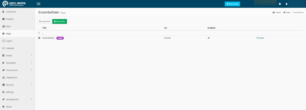
Enhanced Management Environment
GeoApps 29.1 includes several improvements to the management environment, making daily administration more efficient and intuitive.
Key enhancements include:
Smarter tag management for maps and applications
Cleaner and more organized interfaces
Improved navigation and layout structure
Updated styling aligned with the GeoApps Editor
Various hardware and software optimizations
These updates help administrators manage projects, datasets, and applications more effectively while improving overall user experience.
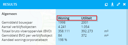
More Powerful Analytics and Reporting
Organizations increasingly rely on data-driven decision-making. To support this, GeoApps 29.1 introduces improvements to analytical reporting.
A new matrix view allows users to display analysis results in structured columns and categories, making reports easier to read and compare.
Benefits include:
Improved reporting clarity
Faster comparison between datasets
Better visibility into analytical results
Stronger support for policy and operational decisions
This enhancement provides greater value for organizations using GeoApps for monitoring, reporting, and strategic planning.
Supporting Custom Application Development
In addition to standard functionality, GeoApps continues to support organizations that require custom solutions.
Through the Developer Portal and extensive documentation, organizations can build tailored applications that integrate with specific workflows, data sources, and operational requirements.
This flexibility allows GeoApps to grow alongside the needs of municipalities, utilities, environmental agencies, consultancies, and other GIS-driven organizations.
GeoApps 29.1 builds upon previous releases with new capabilities for application development, data management, and analytics.
From MapTour support and Multi-Edit functionality to management enhancements and improved reporting tools, this release helps organizations get more value from their geospatial data while improving efficiency across teams.
👉 Explore the latest GeoApps capabilities and discover how Release 29.1 can support your organization.


