Skip to main contentSkip to navigation
ExploreAbout usContactJobs
Log in
MapGear Logo
NewsAbout MapGearJobs
Log inContact
MapGear, known through GeoAppsGeoApps
GeoApps Logo
Apps
Solutions
Platform
About us
Subscriptions
Get advice
GeoApps Logo

GeoApps is the leading software platform for GIS applications and spatial data, enabling organizations to make data-driven decisions.

Solutions

  • Urban Planning
  • Infrastructure
  • Real Estate
  • Environment & Climate
  • Energy Transition
  • Safety & Risk
  • GIS solutions

Products

  • GeoApps
  • Solutions
  • ESG-Maps
  • MapServices
  • TouchTable
  • Consultation
  • Platform

Apps

  • Viewer
  • Dashboard
  • Fieldwork
  • MapTour
  • MapTalk
  • Custom
  • QGIS plugin

For whom?

  • Municipalities
  • Provinces
  • Environmental Services
  • Engineering
  • Contractors
  • Safety Regions
  • Water authorities

Platform

  • Integrations
  • Documentation
  • GIS Lexicon
  • System Status
  • Changelog
  • Support
  • Subscriptions

Company

  • About Us
  • Careers
  • Contact
  • Partners
  • News & Blog
  • Events
  • Case studies

Stay up-to-date

Subscribe to our newsletter to get the latest updates on our products and services. You can unsubscribe at any time.

Keep an eye on our socials too

Stay connected with us through our social media channels and get the latest updates on our products and services.

Quality & trust

MapGear is ISO 9001 and ISO 27001 certified and meets the highest quality and security standards for our products and services.

ISO 9001 Certificering
ISO 27001 Certificering
QGIS Membership 2026
© 2026 MapGear B.V. All rights reserved.
Terms & conditionsPrivacy PolicySustainability statement
Create Quotes Faster with GeoApps: Direct from the Map | GeoApps Blog
Featured image for Create Quotes Faster with GeoApps: Quantities and Costs Directly from the Map
View All Posts
📸 Featured
Insights

Create Quotes Faster with GeoApps: Quantities and Costs Directly from the Map

Location-based quotes often require time-consuming measuring, counting and data collection before the actual calculation can begin. With GeoApps, quantities, areas and costs can be calculated directly from the map as a basis for a more efficient quoting process.

September 22, 2026
GeoApps Team
4 min

For location-based work, preparing a quote often involves a significant amount of work before the actual calculation can even begin. Objects need to be counted, areas measured, lengths calculated and information collected from different sources.

This is where valuable time can easily disappear. With GeoApps, much of this preparation can take place directly in the map. You select the relevant project area, after which the application determines which objects fall within that area and what quantities are involved. By linking this spatial information to unit prices and cost data, you immediately create a stronger basis for the quote.

The quote is not the slow part. Getting to the right numbers is.

For work in public space, the first challenge is understanding exactly what is located within the project area. How many trees or green assets are present? How many square metres of paving need to be included? Which hedges, verges or other maintenance elements fall within the scope?

When this information is collected manually, measuring is only part of the workload. Searching for the right datasets, copying values and checking geographic boundaries all create extra steps before pricing can even begin.

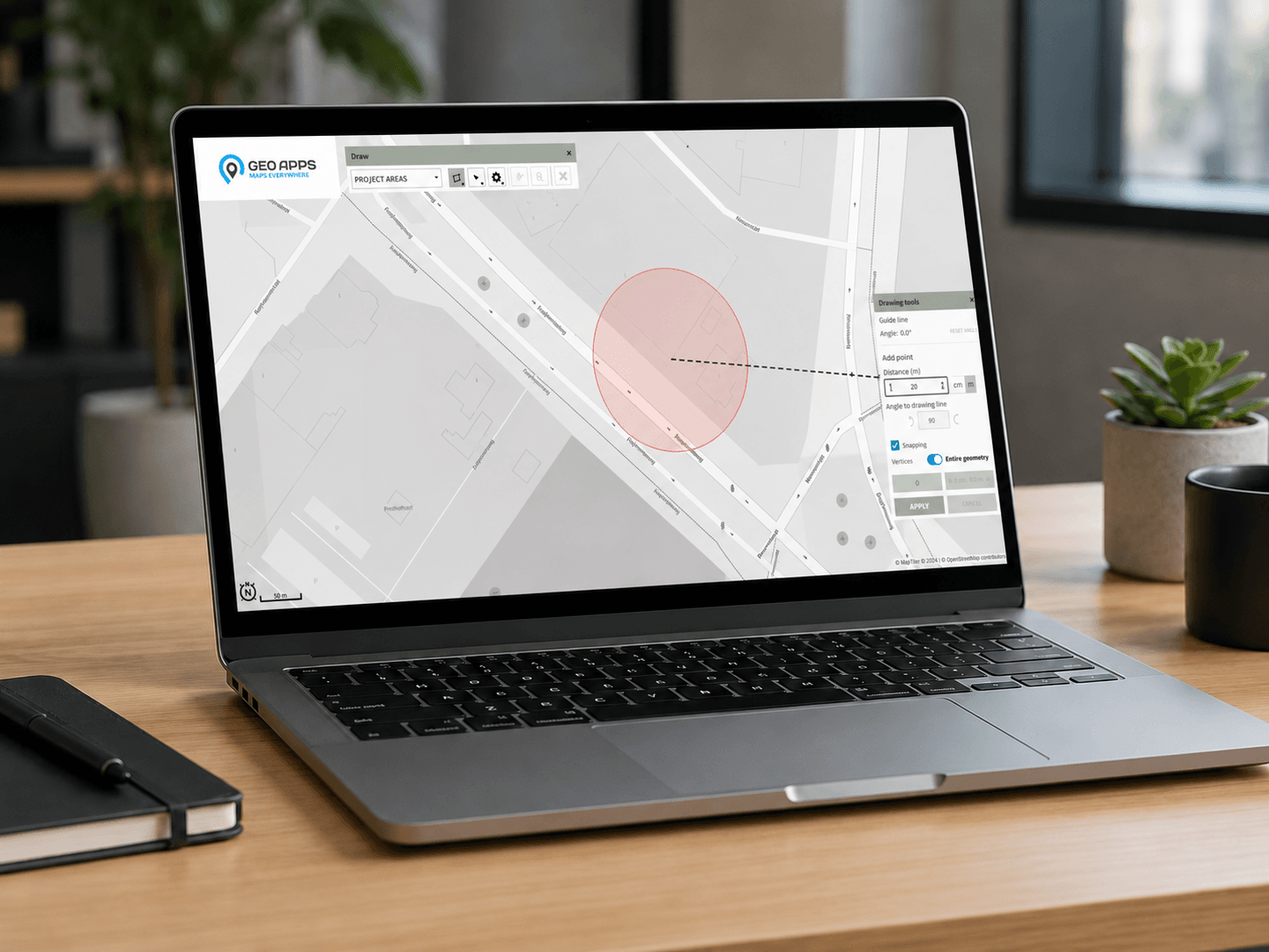
GeoApps organises this preparation spatially. The user draws an analysis area or works with an existing map layer. The application then selects the relevant objects within that area, creating a clear overview of what should be included in the calculation.

🖼️
Image not available
This image could not be loaded

When every project starts with searching and measuring, time disappears before pricing even begins.

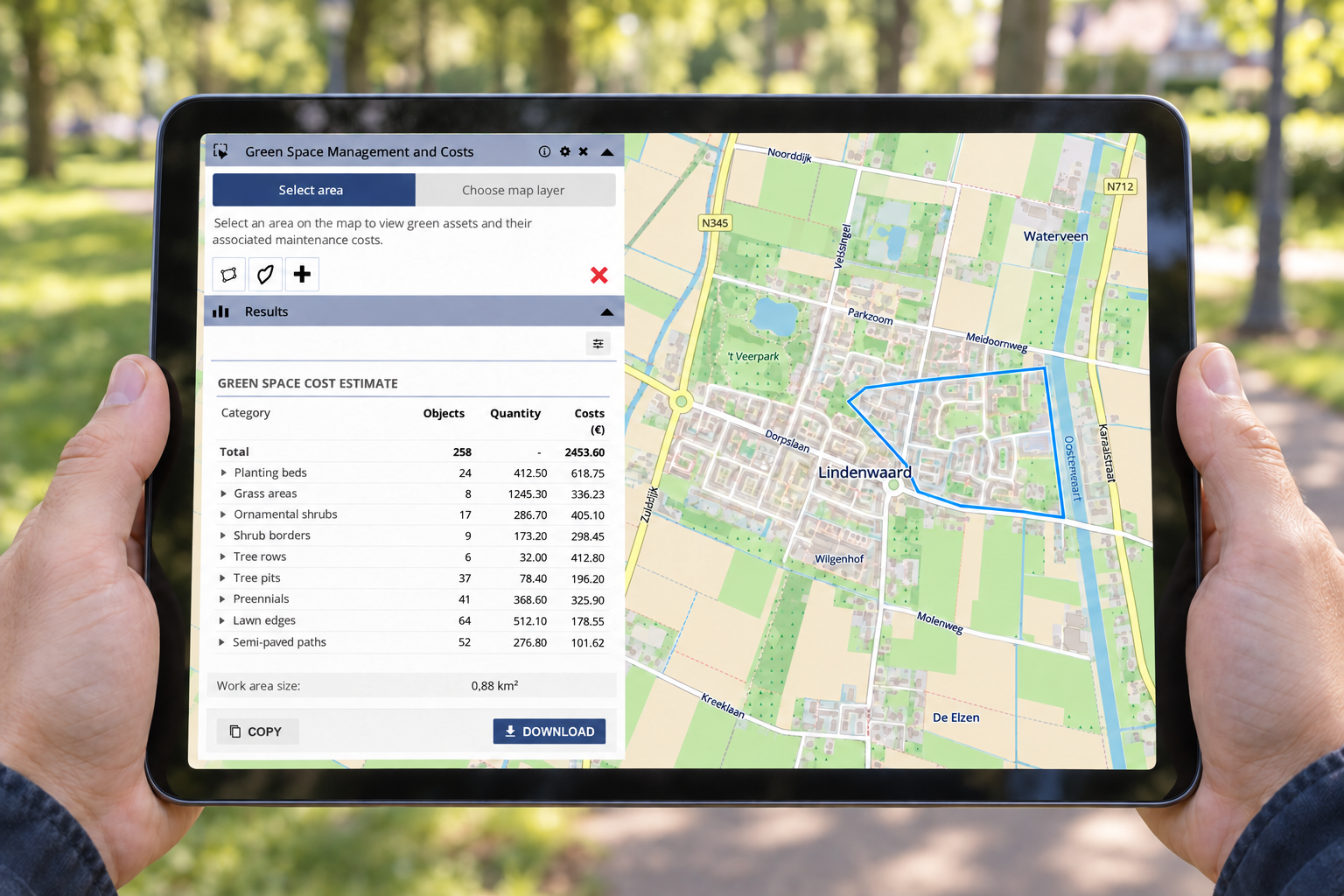
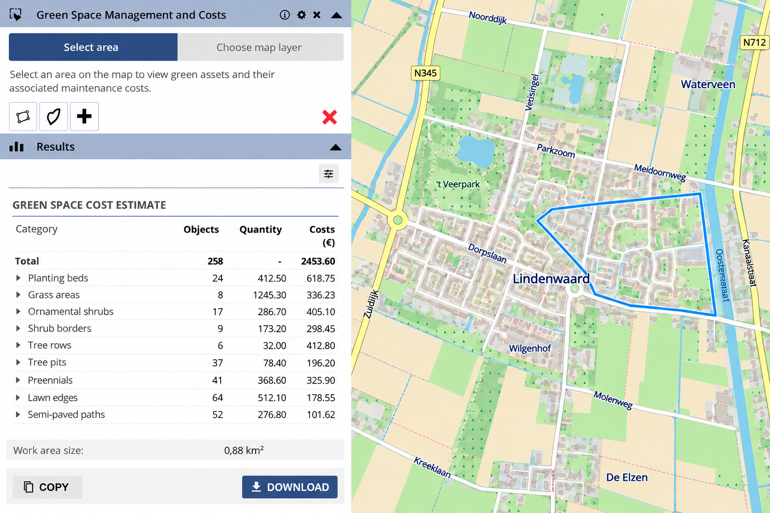
Once the analysis area has been defined, GeoApps can display different calculation data by category. This can include object counts, lengths, areas, unit prices, costs per management category and the total cost for the complete area.

This means the map no longer sits separately from the financial calculation. Spatial characteristics and cost data are connected. An object can, for example, be linked to a unit price, while lengths and areas can be derived directly from its geometry.

The results can then be copied or exported for further use in a quote, cost calculation or report. In practice, this allows GeoApps to become part of the existing workflow without immediately replacing administrative or financial systems.
A cost calculation is only as reliable as the area and objects behind it.

An efficient process is not only about saving time. It should also remain clear which area was analysed, which objects were included and what the calculation was based on.

A GIS-based calculation makes these assumptions easier to understand. If the analysis needs to be repeated later, the geographic boundary and source data remain visible and easier to verify.

Moreover, the calculation can be run again when map layers or pricing tables are updated. As a result, teams can work with more current information without rebuilding the entire calculation from scratch.

The more times data changes hands, the more room there is for uncertainty.

In traditional workflows, spatial information often sits inside the GIS environment while the financial calculation is created somewhere else. Consequently, information regularly needs to be transferred manually between maps, spreadsheets and calculation tools.

Each handover creates additional work. It can also make the process more sensitive to differences between datasets, versions and calculations.

By making quantities available directly from the map, the route from spatial analysis to cost calculation becomes shorter. Information needs to be collected or entered fewer times and remains connected to the actual area the quote relates to.

If every quote starts from scratch, the workflow is doing too much work.

A first application can begin simply with counts, lengths, areas and unit prices. However, as requirements grow, the same approach can be expanded with different pricing levels, maintenance scenarios, material costs, work activities by object type and reporting.

This means the application does not need to remain limited to one type of work. The same GIS-based workflow can support different projects where costs depend on what is actually present at a location.

That makes the approach relevant for contractors, green space managers, engineering consultancies and other organisations that regularly create cost calculations based on spatial objects and areas.

GIS becomes far more valuable when the map helps move the job forward.

A map can show what is located where. Its greater value appears when that information can immediately support the next step, such as a cost calculation, quote or report.

By linking spatial data to quantities and pricing, GeoApps helps teams move more directly from project area to calculation. The same information no longer needs to be repeatedly collected, measured and copied by hand.

As a result, GIS takes on a more practical role within the quoting process: not only showing what is there, but using spatial information directly to support clearer and better-founded calculations.

Want to see how GeoApps can use spatial data in your quoting and cost estimation workflow?

Request a demo

View All PostsGet a Demo

Related Posts

You might also like

Nature restoration becomes measurable: what municipalities should prepare now

Nature restoration becomes measurable: what municipalities should prepare now

The European Nature Restoration Regulation makes reliable monitoring of urban green increasingly important. Discover what this means for municipalities and how spatial data helps demonstrate green development.

August 25, 2026Read more
New in GeoApps: Interactive Demos and Walkthroughs

New in GeoApps: Interactive Demos and Walkthroughs

Discover how interactive demos and walkthroughs guide users directly within GeoApps, helping them learn workflows faster, discover more functionality and work more independently.

July 17, 2026Read more
On-Prem vs. SaaS: Where Should GIS Live in 2026?

On-Prem vs. SaaS: Where Should GIS Live in 2026?

Many organisations are weighing on-premises GIS against SaaS. Discover why a hybrid architecture often provides the best balance between control, flexibility and manageable technical operations.

July 16, 2026Read more
Why GIS Projects Fail (And It’s Rarely Because of the Software)

Why GIS Projects Fail (And It’s Rarely Because of the Software)

A powerful GIS platform cannot compensate for unclear ownership, fragmented data or disconnected teams. Discover why successful GIS environments depend as much on people, processes and responsibilities as they do on technology.

July 13, 2026Read more
Offline GIS with GeoApps: Keep Working Without an Internet Connection

Offline GIS with GeoApps: Keep Working Without an Internet Connection

Internet coverage isn't always available where work happens. With GeoApps' new offline functionality, users can continue working with maps and spatial data anywhere, even without a network connection.

July 2, 2026Read more
From Drawing to Complete Object Registration with Smart Forms

From Drawing to Complete Object Registration with Smart Forms

Discover how GeoApps brings geometry and attribute information together. Smart Forms and conditional fields help users register objects faster, more consistently and with only the fields relevant to each situation.

June 30, 2026Read more

Ready to Get Started?

Join thousands of users who are already using GeoApps to transform their spatial data workflows.

Get a Demo
GeoApps Viewer
Gasfabriek project
MapGear team office
Last Updated: September 22, 2026