AI Detects Solar Panels, but Reliable Data Requires More
AI can identify solar panels quickly across large areas, but automated detection alone does not guarantee reliable policy data. Discover why human validation, current aerial imagery and consistent data processing remain essential.
AI sees a lot. But not always what truly matters.
Artificial intelligence can analyse aerial imagery and identify solar panels across thousands of buildings far more quickly than a completely manual process. For municipalities, provinces and energy regions, this creates new opportunities to update solar inventories and monitor the development of rooftop solar at scale.
However, speed alone does not make a dataset reliable. Automated detection can overlook installations, identify objects that are not solar panels or interpret unclear imagery incorrectly. The quality of the source imagery, the characteristics of the built environment and the way the results are reviewed all influence the final dataset.
Reliable solar monitoring therefore requires more than an algorithm. It depends on a controlled process in which AI accelerates detection while specialists validate uncertain results, correct errors and ensure that the data is suitable for policy, reporting and spatial analysis. MapGear describes its solar-panel detection process as a combination of current aerial imagery, AI and manual review.
AI Accelerates the First Detection
Detecting solar panels across an entire municipality is a substantial task. Roofs vary in shape, material, orientation and visibility, while installations differ in size and configuration. Reviewing every building manually is possible, but it requires considerable time and specialist capacity.
AI helps by screening large volumes of aerial imagery and identifying locations that are likely to contain solar panels. This creates an initial detection layer that specialists can review more efficiently than starting with an empty map.
The technology is especially valuable for:
processing large geographical areas;
recognising recurring visual patterns;
identifying likely installations for further review;
comparing detection results across different image periods;
reducing the amount of repetitive manual inspection.
This makes AI an effective accelerator. It allows the review process to focus on uncertain or unusual situations rather than treating every roof in the same way.
Automated Detection Still Produces Uncertainty
Aerial images contain many objects that can resemble solar panels. Roof windows, dark roof sections, shadows, water features and technical installations can all create false detections. Trees, building extensions and image distortion may also hide panels that are present.
The result can contain two main types of error:
False positives: an object is classified as a solar panel even though it is something else.
False negatives: an existing solar-panel installation is not detected.
The likelihood of these errors depends partly on the imagery. Differences in resolution, lighting, viewing angle, season and image date can affect what the model can recognise. New or unusual panel configurations may also differ from the examples on which a model was trained.
An automated result should therefore not immediately be treated as a definitive inventory. It is a strong starting point that still requires quality control before it can support reporting or decision-making.
Human Validation Turns Detection Into Reliable Data
Human review adds the judgement that automated image recognition cannot always provide. A specialist can evaluate the roof in context, compare uncertain shapes with surrounding objects and decide whether a detection is credible.
Validation can include:
reviewing uncertain detections;
removing objects incorrectly classified as panels;
adding installations missed by the model;
checking whether panels belong to the correct building;
comparing the result with earlier imagery or existing records;
applying consistent definitions across the complete dataset.
The purpose is not to redo the entire process manually. It is to combine the scalability of AI with targeted expert control. AI performs the repetitive first selection, while specialists concentrate on situations where interpretation is required.
This hybrid approach supports both efficiency and consistency. ESG-Maps’ solar offering similarly describes panel detection from aerial imagery as a combination of AI and manual checking, with periodic updates for monitoring.
Reliable Detection Supports Better Solar Policy
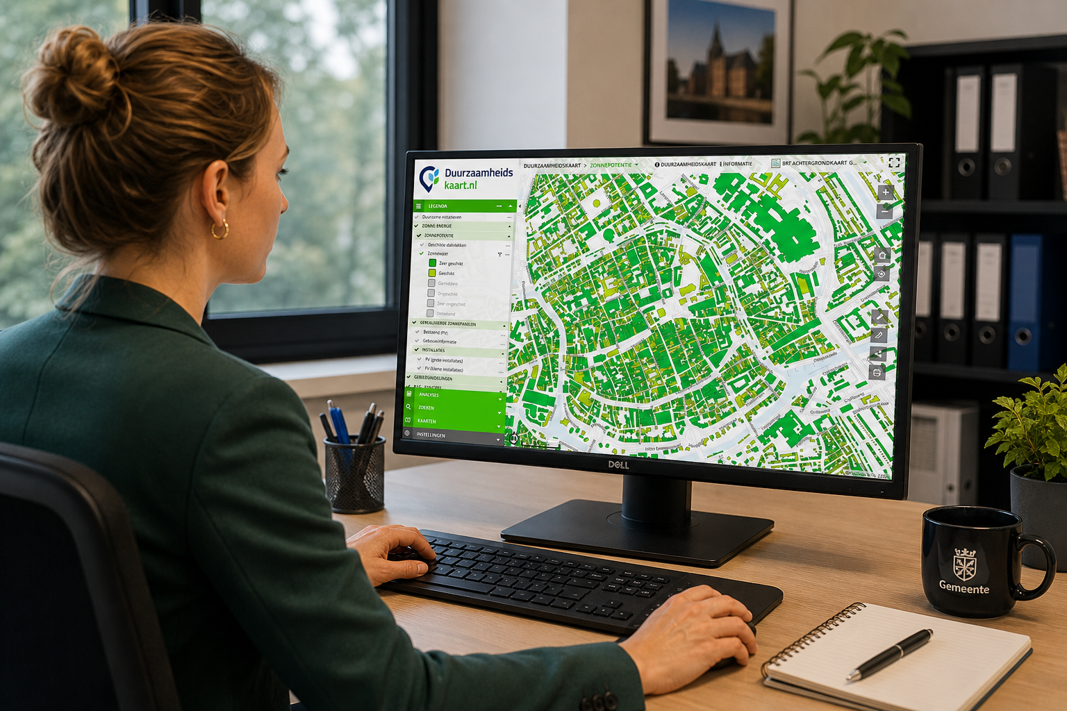
Municipalities need more than a map containing possible solar-panel locations. They need data that can be compared with roof potential, neighbourhood boundaries, installed capacity and policy objectives.
A validated dataset can help answer questions such as:
How many buildings already have solar panels?
In which neighbourhoods is adoption growing?
Where does substantial unused rooftop potential remain?
How does the current situation compare with an earlier measurement?
Which areas may need additional communication or policy support?
How much of the estimated rooftop potential is already being used?
When inaccurate detections remain in the dataset, these conclusions can become distorted. An overestimate may suggest that a neighbourhood is performing better than it is, while missing installations can understate actual progress.
For that reason, data quality is not merely a technical concern. It directly affects monitoring, reporting and the priorities selected by policymakers. ESG-Maps positions its solar data around installed capacity, rooftop potential and progress by area for municipalities, provinces and RES monitoring.
Current Imagery and Consistent Methods Matter
Even a carefully validated dataset becomes less useful as the physical environment changes. New installations are added, existing panels are removed and buildings are altered. Solar monitoring should therefore be repeated using sufficiently current aerial imagery.
Consistency between measurement periods is equally important. When detection rules or definitions change without documentation, an apparent increase or decline may partly reflect a methodological difference rather than a real change on the ground.
A reliable monitoring process should therefore establish:
which aerial imagery is used;
the date or period represented by that imagery;
what counts as a solar-panel installation;
how uncertain objects are reviewed;
how results are linked to buildings or areas;
how changes between measurement periods are calculated;
when the dataset will next be updated.
These agreements make results more transparent and help teams interpret trends correctly.
Use AI as Part of a Controlled Data Process
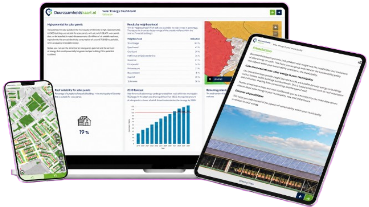
AI can significantly accelerate solar-panel detection, but it should be treated as one component of the complete workflow. The algorithm identifies likely objects, specialists validate the results and the approved data is then connected to maps, dashboards and reporting.
This produces a practical workflow:
Current aerial imagery → AI-assisted detection → human validation → structured solar dataset → monitoring and policy insight
The strongest result is not the dataset produced with the least human involvement. It is the dataset that achieves an appropriate balance between processing speed, traceability and accuracy. By combining automation with expert review, organisations can benefit from AI without allowing uncertain detections to become unreliable policy figures.
Would you like a current and carefully reviewed picture of installed solar panels, unused rooftop potential and progress across your municipality or region?
ESG-Maps combines solar-panel detection, manual quality control and interactive monitoring to turn aerial imagery into spatial information for policy and reporting.
Ready to get started?
Discover how Duurzaamheidskaart can support your organization.