Make open data accessible to non-technical colleagues with GeoApps as a map library
To make data and geodata accessible within your organization, you can use the GeoApps Viewer as a knowledge base or map library. By bringing all data together in one central location, your organization gains the fastest route to reliable and up-to-date data and insights. With all data clearly at hand, you can also prepare proposals more quickly.

Over time, you also build up a catalog, which leads to a more uniform way of working. This ensures that data is always findable and accessible during projects. That saves both time and money!
Create and publish smart & innovative end products
With GeoApps, you can develop new revenue models in an innovative way. What truly sets GeoApps apart as an innovative solution are the powerful tools such as Dashboards, MapTour, and MapTalk.
With the Dashboard functionality of GeoApps, you can combine complex data into interactive overviews with maps and charts, giving your clients instant insights without needing technical knowledge.
MapTour makes it easy to present data through engaging slide shows with maps, text, and images, making your story visually appealing and easy to understand.
MapTalk offers a powerful participation tool that allows users to provide direct input on maps, such as points, lines, and comments, increasing both engagement and the effectiveness of your projects.
With these tools, you can not only present your expertise in an accessible way but also develop new revenue models. By combining these innovative features, you save time, make your work more scalable, and increase the impact of your services.
Since you are working with a SaaS solution, you can also offer (part of) your services on a subscription basis. For example, you could provide insights into the need for a soil survey or the extent of a heat stress problem as a service before carrying out the actual work. This gives your clients greater confidence in the work you perform for them and promotes your expertise in a more approachable way to potential clients, helping you reach a wider audience.
You also reuse the knowledge and data gained from previous projects. This makes the work scalable and requires less time to set up maps or data analyses. With GeoApps, you can save both time and costs.
Collaborate effectively in a user-friendly online environment
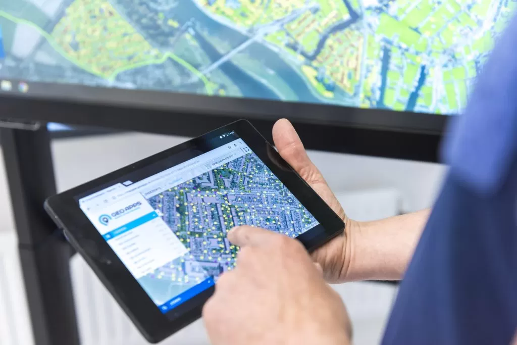
GeoApps works entirely in the browser, which means you can easily share your insights with colleagues via permalinks. This bridges the gap between GIS experts and non-GIS experts, helping people better understand each other’s reasoning by looking at the same location and information.
In addition, GeoApps always provides access to up-to-date information instead of quickly outdated reports and maps. Everyone views the same data, and you can see exactly when it was last updated.
As a versatile platform, GeoApps enables you to meet a wide range of customer needs by delivering end products in different forms such as data downloads, web services, or ready-to-use tools and solutions. The broad possibilities make it a flexible and cost-efficient solution for your organization.
The platform also provides a secure environment in which you can grant targeted access to authorized users, enhancing both data security and collaboration. Moreover, GeoApps can be used broadly without extra costs for separate licenses, making it an even more cost-effective solution.
Get started with GeoApps
Several consultancy firms are already working with this approach and are seeing their growth accelerate. Do you also want to take your organization to the next level? Book a demo and we will be happy to explore the possibilities with you.