
Access high-quality street-level imagery and historical views without leaving your desk.

Access high-quality street-level imagery and historical views without leaving your desk.
How Cyclomedia Street Smart connects to the GeoApps GIS platform for maps, data and collaboration.
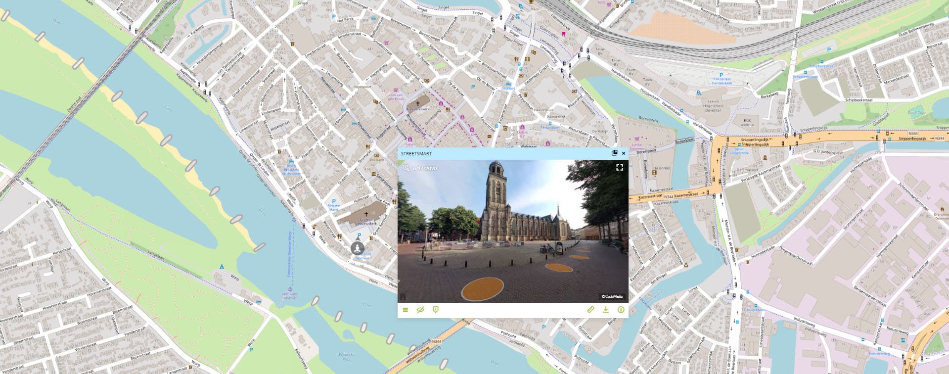
GeoApps embeds Cyclomedia Street Smart in the viewer: street imagery and historical views open inside the GeoApps app. The street images give you an up-to-date picture of the situation on the street, without having to go outside. These photos are updated every year, allowing you to look back at how the situation has changed over several years. This integration provides seamless access to comprehensive street-level data for planning, analysis, and decision-making processes.
High-quality street-level imagery
Access to historical street imagery
Measure distances and objects in street view
Contact us to discuss how we can help with your integration needs.

Practical answers about integrating Cyclomedia Street Smart with GeoApps.

