


MapGear implemented Slagboom & Peeters’ geo-oblique imagery in GeoApps, allowing users to inspect objects from multiple directions using detailed 45° aerial photography. Following a pilot with six municipalities, the integration made an additional spatial perspective available directly within users’ familiar map environment.
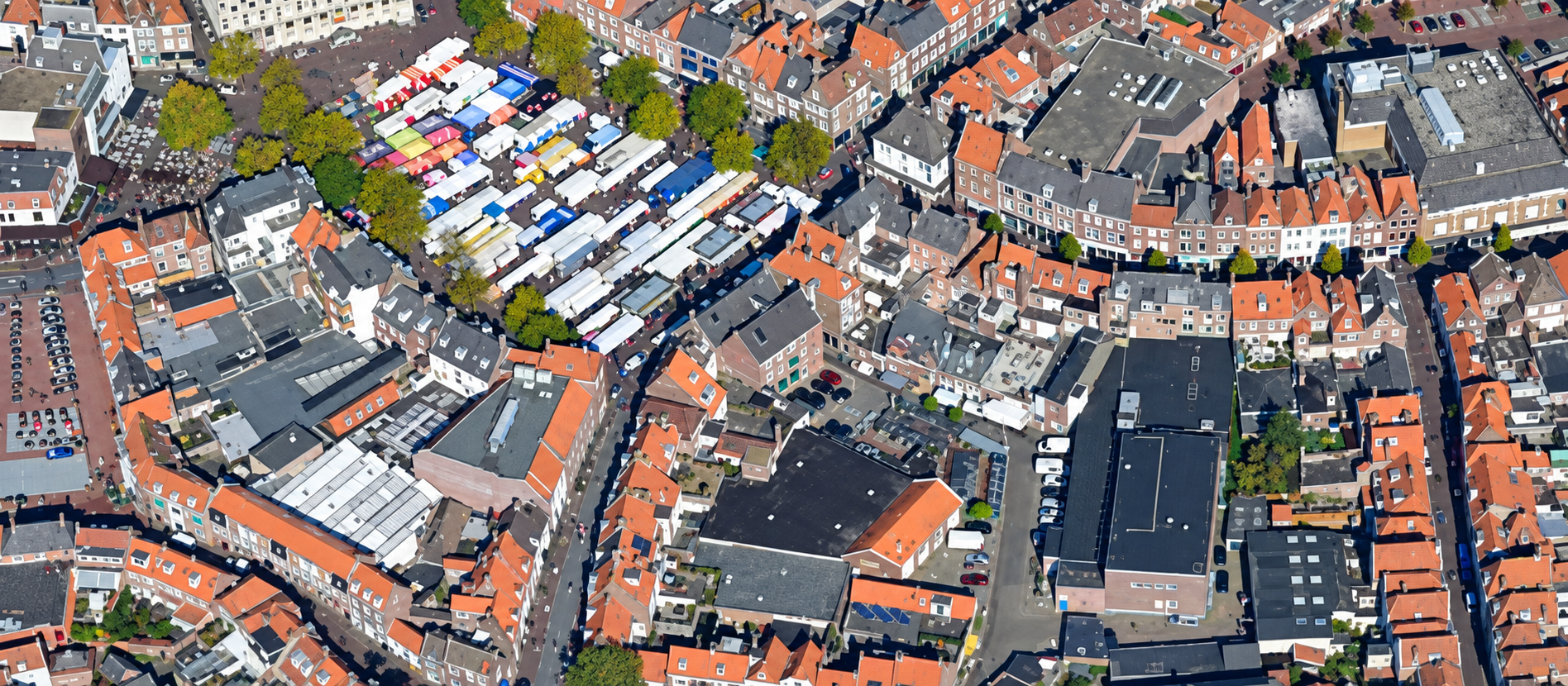
Looking straight down at a city can tell you a lot. However, some of the details that matter most are exactly the ones a top-down image cannot show. Façades, permanent extensions, screened objects and structures hidden behind other features can be difficult to assess from an orthophoto alone. For municipalities working with detailed property and public-space information, that missing perspective can mean additional investigation before the real situation becomes clear.
Slagboom & Peeters specialises in aerial photography and geo-oblique imagery. To make that imagery easier to use within existing spatial workflows, the company commissioned MapGear to develop a new Geo-Oblique Viewer. MapGear also integrated the viewer into GeoApps, bringing an additional visual perspective directly into the map environment already used by spatial professionals.
Traditional orthophotos provide a consistent view of the ground from above and remain essential for GIS work. Yet their strength is also their limitation: looking vertically down can make it difficult to understand vertical structures and objects that are partly obscured. Geo-oblique imagery tackles that problem by showing the same environment from a different angle.
Slagboom & Peeters records its geo-oblique photographs at approximately 45 degrees. Because the images are geo-referenced, users can search for an object and inspect it from four cardinal directions. As a result, they gain a more complete visual impression of buildings and their surroundings than a top-down image alone can provide. Instead of seeing only a roof and footprint, users can examine more of the actual structure around it. Sometimes better spatial insight does not require more data. It requires seeing the same place from the right angle.
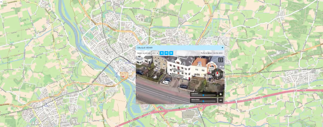
Before the integration became available more broadly, the Geo-Oblique Viewer was piloted with six municipalities. Following that pilot, GeoApps users could access the imagery directly through their familiar map viewer. This matters because the benefit is not simply having another set of aerial photographs. The imagery becomes far more practical when users can reach it without leaving the spatial environment in which they already work.
Municipalities commonly use geo-oblique imagery for Dutch public registers and property-related processes such as BGT, the large-scale topographic register; BAG, the national buildings and addresses register; and WOZ, the property valuation system. Slagboom & Peeters also identifies applications in planning, construction, infrastructure and green-space management. Consequently, one additional viewing angle can support several departments rather than serving only a specialist aerial-imagery workflow.
The practical difference becomes clear when an object is difficult to assess from above. For example, fixed extensions, screened structures and other less-visible features become easier to inspect when users can move between different angled views. Slagboom & Peeters specifically identifies these situations as areas where geo-oblique imagery provides information beyond what a standard orthophoto can show. As a result, a user can build a clearer picture of a location before deciding whether further analysis or an on-site inspection is necessary.
Moreover, MapGear designed the viewer to support more than aerial photographs. The implementation was also suitable for working with 3D models and LiDAR data, creating opportunities to combine several forms of detailed spatial information in the same viewing environment. Therefore, the goal was not simply to introduce a visually impressive image source. It was to make richer spatial context usable within an operational GIS workflow.
The implementation also addressed the other side of the process: getting imagery from Slagboom & Peeters to the organisations that need it. For that reason, the application included a management module through which Slagboom & Peeters employees could make collected aerial photographs and geo-oblique imagery available directly to customers.
In practice, this connects imagery acquisition with delivery. Slagboom & Peeters can manage the collected material, while customers can access the spatial imagery through the applications they use for their work. Today, GeoApps continues to offer Slagboom & Peeters oblique imagery as a specialist image-service integration for organisations with the corresponding Slagboom & Peeters subscription. Ultimately, high-quality imagery creates much more value when it is not isolated from the rest of the GIS workflow.
No single spatial perspective answers every question. Orthophotos remain essential for understanding location and layout from above. However, when users need to understand what sits between, beside or underneath those visible rooflines, another perspective can make the difference. By implementing Slagboom & Peeters’ geo-oblique imagery in GeoApps, MapGear brought 45° aerial photography, multiple viewing directions and existing spatial data into one workflow.
For municipalities and other spatial professionals, the value is straightforward: when the top-down view leaves a blind spot, they have another way to investigate the real situation. GeoApps brings maps, aerial imagery and other spatial information together in an accessible GIS environment for analysis and everyday decision-making.
Need more visual context behind your spatial data?
Let's discuss how GeoApps can help bring your vision to life
Let's discuss your use case.

