Powerful GIS applications. Open standards. European support.
GeoApps is the European alternative to ArcGIS for modern Web GIS. Create maps, dashboards, fieldwork apps and spatial workflows in one platform, connect existing data and GIS infrastructure, work alongside QGIS, and make geographic information accessible across the organization, without building your stack around a single proprietary ecosystem.
Trusted by 300+ organizations for spatial challenges across government, infrastructure, engineering and the built environment.
GeoApps
Your GIS stack should give you options
ArcGIS is an established and powerful ecosystem. But not every organization needs the cost, licensing structure and ecosystem dependency that can come with deploying it across an entire organization.
GeoApps is designed for organizations looking for a different approach to Web GIS:
01
Open standards, including OGC
Connect existing data sources via WMS, WMTS and WFS. GeoApps supports those open OGC specifications; it is not an OGC product or member. GeoServer and other open GIS components stay connectable too.
02
Built to work with QGIS
Use QGIS for advanced desktop analysis and GeoApps to publish data, maps and applications to colleagues, stakeholders and external users. GeoApps provides a QGIS plugin for moving data between desktop and web workflows.
03
Less dependence on a single ecosystem
Your data, services and desktop tools stay yours. Swap components, grow, or change the stack without having to replace the entire GIS landscape.
04
European support, directly from the team building the platform
GeoApps is developed by MapGear in the Netherlands. Technical support comes directly from its GIS specialists and developers rather than an outsourced support layer.
The modern GIS architecture
A modern way of working with GIS
Put maps online for the whole organisation, while QGIS, ArcGIS Pro and your own data, open data and external sources stay right where they are.
Your GIS architecture stays modular, desktop, data and Web GIS reinforce each other.
Web GIS · GeoApps
Maps, dashboards, fieldwork and organization-wide access
Desktop GIS
QGIS or ArcGIS Pro for specialist data processing and analysis
Databases & services
PostgreSQL, APIs and OGC / ArcGIS services from and into GeoApps
Proven in complex public-sector and engineering environments
Organizations across government and engineering use GeoApps for Web GIS, from district atlases to custom applications built on open standards.
Municipality
Wijkatlas: spatial information for one of Europe's largest cities
Rotterdam selected GeoApps in an RFP with 100+ requirements, instead of continuing with Esri. Wijkatlas now brings district data and maps together across the organization.
“Thanks to GeoApps, we have all data and maps per district in one place. We can immediately visualize and share our urban challenges, making decision-making with colleagues and partners much faster and more transparent.”
Stantec built apps such as the GIM portal and Bodemadviseur on GeoApps, with full control over development and rapid adoption by their own teams.
“We wanted control over further development ourselves. With the modular GeoApps building blocks, we built two applications in-house, precisely tailored to users, and our devs picked up the new stack lightning fast.”
Your GIS environment increasingly has to satisfy more than a feature checklist. It needs to fit your architecture, security requirements, procurement environment and long-term technology strategy.
European vendor
Developed and supported from the Netherlands.
ISO 9001 & ISO 27001
Enterprise-grade quality and information-security processes.
Open GIS ecosystem
Designed to work alongside QGIS, GeoServer and standard geospatial services.
Direct specialist support
A direct line to the people who develop and implement the platform.
GeoApps vs. ArcGIS
GeoApps can serve as an alternative to Esri for organizations like those above, and as a complement to ArcGIS Pro for teams that keep specialist desktop workflows. GeoApps is strongest where organizations want flexible, cost-effective Web GIS and organization-wide access to spatial information.
Feature
GeoApps
ArcGIS
Modern Web GIS
Interactive maps & dashboards
Field applications
QGIS integration
Open-source friendly architecture
Open standards and existing tools
Own ecosystem, with connectors outward
OGC services
Local European support
Depends on implementation
Advanced desktop GIS
Use QGIS alongside GeoApps
ArcGIS Pro
Pricing model
Subscription per environment
Named users, plus credits for some Online services
Cost predictability
Fixed Web GIS budget
Credits for storage, analysis and premium content can scale with use
License cost profile
Often lower for organization-wide Web GIS
Named users and enterprise agreements add up quickly
Suitable for gradual migration
Run the cost comparison
The license cost profile depends on user count, user types and credits. The ROI calculator below makes that comparison indicative and calculable — including the difference between a subscription per environment and named users.
Wählen Sie die Größe Ihrer Organisation
Click on an option to select your organization size
Kostenvergleich
ArcGIS
ArcGIS Online
Viewer user types (20 Betrachter)€2.600
Creator user types (5 Editoren)€5.425
Professional user types für Administratoren / GIS-Administratoren (2)€4.000
Gesamtjahreskosten€12.025
Creator umfasst ArcGIS Pro Basic. Professional umfasst ArcGIS Pro Standard.
SchulungenOptional: 3-tägiges ArcGIS Pro-Training über Esri erhältlich für 2.115 € exkl. MwSt..
Optional: QGIS-LizenzenEinsatz von Open-Source Desktop-GIS, inklusive GeoApps Plugin zur Synchronisation von Daten in Ihre Online-Kartenumgebung.
Kostenlos
SchulungenStandard GeoApps-Implementierung (Nicht in Berechnung enthalten). Zusätzliche QGIS-Schulungen auf Anfrage über MapGear oder die QGIS Community.
€1.495
Sie sparen 66% jährlich
Das sind €7.957 zurück in Ihrem Budget jedes Jahr
Diese Berechnungen sind Schätzungen basierend auf Standardpreisen. Kontaktieren Sie uns für ein detailliertes Angebot.
GeoApps is a product of MapGear B.V., based in the Netherlands. Esri, ArcGIS and ArcGIS Pro are trademarks of Environmental Systems Research Institute, Inc. GeoApps and MapGear are not affiliated with or endorsed by Esri.
Considering an alternative to your current legacy GIS setup?
You do not need to migrate your entire GIS environment to find out whether GeoApps fits. Start by looking at your current architecture, applications, users and ArcGIS dependencies. We can then identify which workflows could move to GeoApps, which specialist tools should remain, and what a practical migration path could look like.
Kurze Antworten auf die häufigsten Fragen zu GeoApps.
Was ist GeoApps?
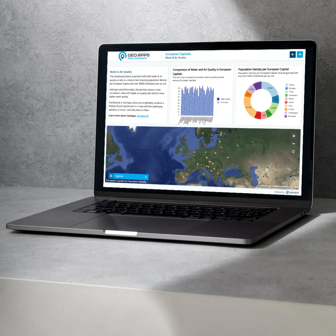
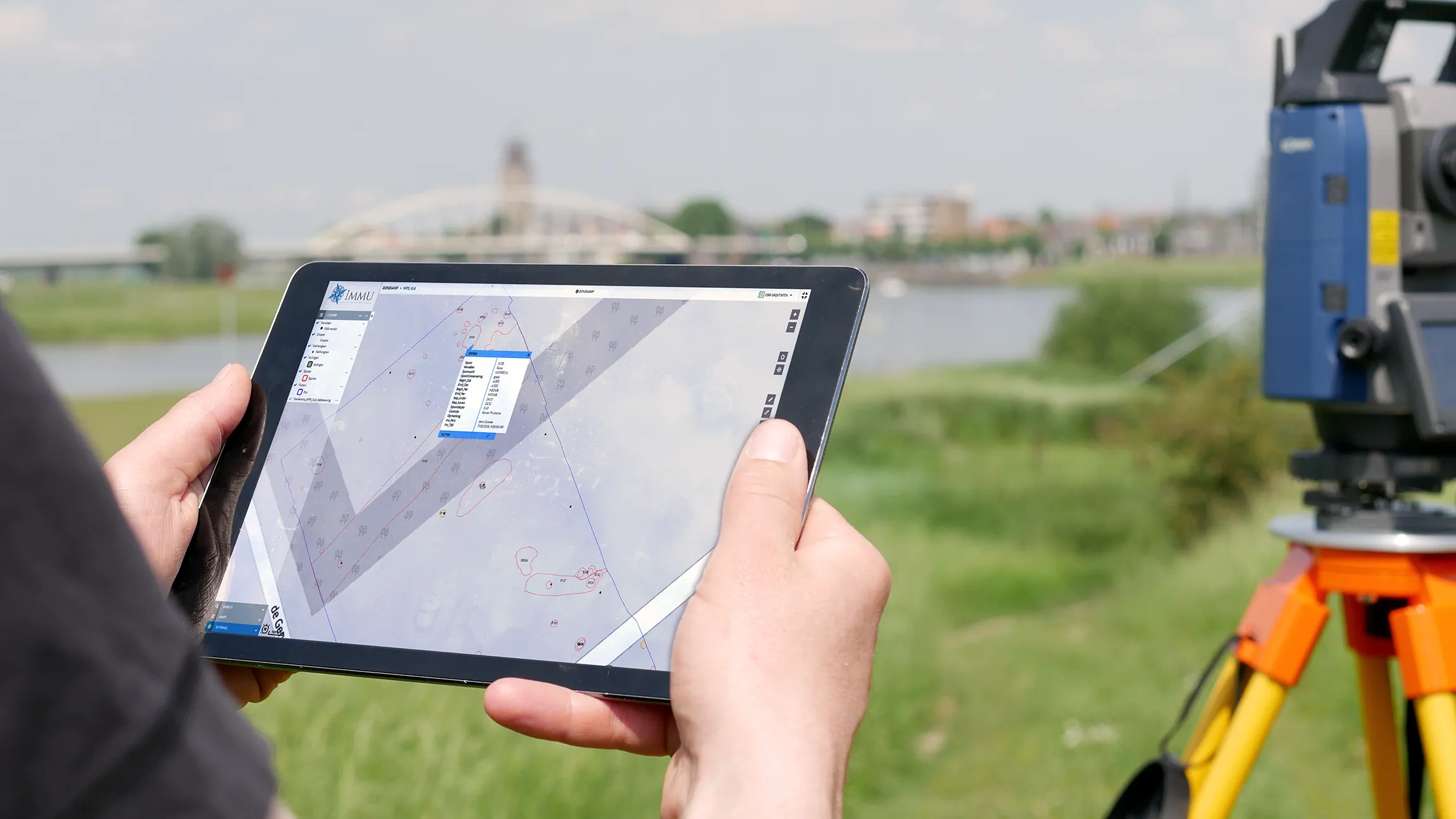
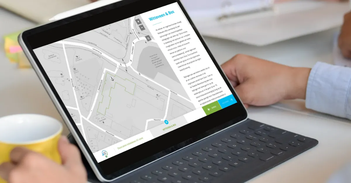
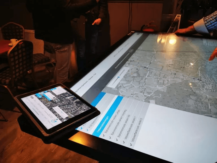
GeoApps ist eine leistungsstarke, flexible Plattform zum Erstellen, Verwalten und Bereitstellen kartenbasierter Anwendungen, die die Art und Weise verändert, wie Organisationen mit räumlichen Daten arbeiten. Unsere Kernprodukte umfassen Dashboard für Echtzeit-Datenvisualisierung und Analytik, Viewer für interaktive Kartenerkundung und -freigabe, Fieldwork für mobile Datenerfassung im Feld, MapTalk für geleitetes Storytelling mit Karten und TouchTable für kollaborative Touchscreen-Erfahrungen. Im Gegensatz zu traditioneller GIS-Software konzentriert sich GeoApps auf Benutzerfreundlichkeit und Zugänglichkeit, wodurch komplexe räumliche Daten für jeden von Feldarbeitern bis hin zu Führungskräften verständlich und handlungsorientiert werden. Organisationen nutzen GeoApps, um Workflows zu optimieren, Entscheidungsfindungen zu verbessern und ansprechende Erfahrungen für Stakeholder und Bürger zu schaffen.
Ist GeoApps eine SaaS?
Ja. GeoApps ist das Web-GIS von MapGear: gehostete Karten, Dashboards, Feldarbeit und Beteiligung als Abonnement, mit optionaler Implementierung und Support. Es ist kein Desktop-GIS und kein Lead-Generierungsdienst. Spezialisten können in QGIS oder ArcGIS Pro weiterarbeiten; GeoApps veröffentlicht dieselben Daten für die übrige Organisation. MapGear bietet in derselben Produktfamilie auch MapTalk, MapServices, TouchTable und ESG Maps.
Ist GeoApps eine europäische Alternative zu ArcGIS Online?
Ja. GeoApps ist das Web-GIS von MapGear in den Niederlanden: Karten, Dashboards und Feldarbeit für die ganze Organisation veröffentlichen. Desktop-GIS wie QGIS oder ArcGIS Pro sowie vorhandene Datenbanken und Dienste bleiben daneben. Organisationen nutzen GeoApps als europäische Alternative zu ArcGIS Online oder neben ArcGIS Pro. Architektur, offene Standards und ein Vergleich stehen in der Wissensdatenbank unter Europäische Alternative zu ArcGIS.
Funktioniert GeoApps mit QGIS und offenen Standards?
Ja. Spezialisten analysieren weiter in QGIS; Viewer und der Rest von GeoApps veröffentlichen dieselben Daten an Teams und externe Nutzer. Ein QGIS-Plugin verbindet Desktop und Web. GeoApps unterstützt offene Spezifikationen wie WMS, WMTS und WFS. Es ist kein OGC-Produkt oder -Mitglied. Daten, Dienste und Desktop-Werkzeuge bleiben bei Ihnen.
Wie fordere ich eine Demo an?
Eine Demo-Anforderung ist unkompliziert und auf Ihre Bedürfnisse zugeschnitten. Besuchen Sie unsere Demo-Seite und füllen Sie das Kontaktformular mit Details zu Ihrer Organisation, aktuellen Herausforderungen und Zielen aus. Wir antworten innerhalb eines Arbeitstages, um einen Anruf zu vereinbaren und Ihre spezifischen Anforderungen zu verstehen. Während der Demo zeigen wir relevante Anwendungsfälle, demonstrieren Integrationen mit Ihren bestehenden Systemen und besprechen Implementierungsansätze. Für Organisationen mit komplexen Anforderungen können wir erweiterte Sitzungen, Pilotprogramme oder Vor-Ort-Demonstrationen arrangieren. Der Prozess ist unverbindlich, und viele Organisationen nutzen ihn, um mehrere Lösungen zu evaluieren, bevor sie Entscheidungen treffen.
Was brauchen Sie von uns für den Start?
Wir brauchen vor allem Klarheit darüber, was Sie erreichen wollen. Fordern Sie Beratung an, dann starten wir mit einem Intake: Ziel klären und Gespräche planen. Wir helfen Ihnen weiter mit GIS-Beratung, Datensätzen etwa aus MapServices und ESG Maps sowie mit Schulung und Adoption.
Wie schnell können wir starten?
Ein GIS-Viewer ist typischerweise innerhalb weniger Wochen live, wenn Use-Case und Datenquellen klar sind. Sind Daten- oder Beratungsarbeit nötig, oder eine umfassendere Einrichtung mit Anbindungen, Rechten und Schulung, dauert das typischerweise zwei bis acht Wochen. Danach läuft der Support weiter.
Was, wenn GeoApps nicht die richtige Wahl ist?
Das entscheiden Sie, nicht wir. Eine Demo oder ein kurzer Pilot zeigt, ob Viewer, Fieldwork oder MapTalk Ihren Teams wirklich hilft. Wir arbeiten mit Organisationen, die bereits GIS-Daten oder eine klare Kartenfrage haben: Kommunen, Provinzen, Netzbetreiber und Ingenieurbüros. Passt es nicht, sagen wir das. Nach dem ersten Gespräch gehen Sie keine Verpflichtung ein.