Powerful GIS applications. Open standards. European support.
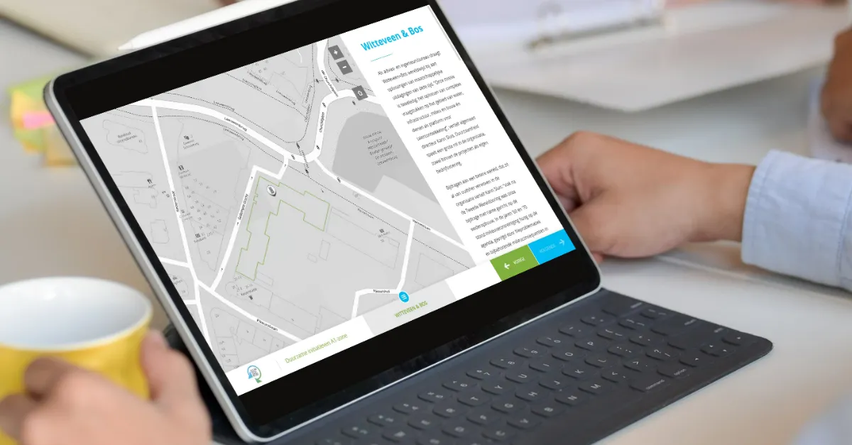
GeoApps is the European alternative to ArcGIS for modern Web GIS. Create maps, dashboards, fieldwork apps and spatial workflows in one platform, connect existing data and GIS infrastructure, work alongside QGIS, and make geographic information accessible across the organization, without building your stack around a single proprietary ecosystem.
Trusted by 300+ organizations for spatial challenges across government, infrastructure, engineering and the built environment.
GeoApps
Your GIS stack should give you options
ArcGIS is an established and powerful ecosystem. But not every organization needs the cost, licensing structure and ecosystem dependency that can come with deploying it across an entire organization.
GeoApps is designed for organizations looking for a different approach to Web GIS:
01
Open standards, including OGC
Connect existing data sources via WMS, WMTS and WFS. GeoApps supports those open OGC specifications; it is not an OGC product or member. GeoServer and other open GIS components stay connectable too.
02
Built to work with QGIS
Use QGIS for advanced desktop analysis and GeoApps to publish data, maps and applications to colleagues, stakeholders and external users. GeoApps provides a QGIS plugin for moving data between desktop and web workflows.
03
Less dependence on a single ecosystem
Your data, services and desktop tools stay yours. Swap components, grow, or change the stack without having to replace the entire GIS landscape.
04
European support, directly from the team building the platform
GeoApps is developed by MapGear in the Netherlands. Technical support comes directly from its GIS specialists and developers rather than an outsourced support layer.
The modern GIS architecture
A modern way of working with GIS
Put maps online for the whole organisation, while QGIS, ArcGIS Pro and your own data, open data and external sources stay right where they are.
Your GIS architecture stays modular, desktop, data and Web GIS reinforce each other.
Web GIS · GeoApps
Maps, dashboards, fieldwork and organization-wide access
Desktop GIS
QGIS or ArcGIS Pro for specialist data processing and analysis
Databases & services
PostgreSQL, APIs and OGC / ArcGIS services from and into GeoApps
Proven in complex public-sector and engineering environments
Organizations across government and engineering use GeoApps for Web GIS, from district atlases to custom applications built on open standards.
Municipality
Wijkatlas: spatial information for one of Europe's largest cities
Rotterdam selected GeoApps in an RFP with 100+ requirements, instead of continuing with Esri. Wijkatlas now brings district data and maps together across the organization.
“Thanks to GeoApps, we have all data and maps per district in one place. We can immediately visualize and share our urban challenges, making decision-making with colleagues and partners much faster and more transparent.”
Stantec built apps such as the GIM portal and Bodemadviseur on GeoApps, with full control over development and rapid adoption by their own teams.
“We wanted control over further development ourselves. With the modular GeoApps building blocks, we built two applications in-house, precisely tailored to users, and our devs picked up the new stack lightning fast.”
Your GIS environment increasingly has to satisfy more than a feature checklist. It needs to fit your architecture, security requirements, procurement environment and long-term technology strategy.
European vendor
Developed and supported from the Netherlands.
ISO 9001 & ISO 27001
Enterprise-grade quality and information-security processes.
Open GIS ecosystem
Designed to work alongside QGIS, GeoServer and standard geospatial services.
Direct specialist support
A direct line to the people who develop and implement the platform.
GeoApps vs. ArcGIS
GeoApps can serve as an alternative to Esri for organizations like those above, and as a complement to ArcGIS Pro for teams that keep specialist desktop workflows. GeoApps is strongest where organizations want flexible, cost-effective Web GIS and organization-wide access to spatial information.
Feature
GeoApps
ArcGIS
Modern Web GIS
Interactive maps & dashboards
Field applications
QGIS integration
Open-source friendly architecture
Open standards and existing tools
Own ecosystem, with connectors outward
OGC services
Local European support
Depends on implementation
Advanced desktop GIS
Use QGIS alongside GeoApps
ArcGIS Pro
Pricing model
Subscription per environment
Named users, plus credits for some Online services
Cost predictability
Fixed Web GIS budget
Credits for storage, analysis and premium content can scale with use
License cost profile
Often lower for organization-wide Web GIS
Named users and enterprise agreements add up quickly
Suitable for gradual migration
Run the cost comparison
The license cost profile depends on user count, user types and credits. The ROI calculator below makes that comparison indicative and calculable — including the difference between a subscription per environment and named users.
Choisissez la taille de votre organisation
Click on an option to select your organization size
Comparaison des coûts
ArcGIS
ArcGIS Online
Viewer user types (20 visualiseurs)€2.600
Creator user types (5 éditeurs)€5.425
Professional user types pour administrateurs / administrateurs SIG (2)€4.000
Coût annuel total€12.025
Creator inclut ArcGIS Pro Basic. Professional inclut ArcGIS Pro Standard.
Formation & onboardingOptionnel : formation ArcGIS Pro de 3 jours proposée par Esri pour 2 115 € HT.
Coût annuel total€339 par mois, abonnement annuel€4.068
Optionnel : Licences QGISUtilisation d'un SIG bureautique open source, incluant le plugin GeoApps pour synchroniser les données vers votre environnement de cartes en ligne.
Gratuit
Formation & onboardingMise en œuvre standard GeoApps (Non inclus dans le calcul). Formation QGIS supplémentaire disponible sur demande via MapGear ou la communauté QGIS.
€1.495
Vous économisez 66% annuellement
C'est €7.957 de retour dans votre budget chaque année
Ces calculs sont des estimations basées sur les prix standard. Contactez-nous pour un devis détaillé.
GeoApps is a product of MapGear B.V., based in the Netherlands. Esri, ArcGIS and ArcGIS Pro are trademarks of Environmental Systems Research Institute, Inc. GeoApps and MapGear are not affiliated with or endorsed by Esri.
Considering an alternative to your current legacy GIS setup?
You do not need to migrate your entire GIS environment to find out whether GeoApps fits. Start by looking at your current architecture, applications, users and ArcGIS dependencies. We can then identify which workflows could move to GeoApps, which specialist tools should remain, and what a practical migration path could look like.
Réponses courtes aux questions les plus fréquentes sur GeoApps.
Qu'est-ce que GeoApps ?
GeoApps est une plateforme puissante et flexible pour créer, gérer et déployer des applications cartographiques qui transforment la façon dont les organisations travaillent avec les données spatiales. Nos produits principaux incluent Dashboard pour la visualisation et l'analyse de données en temps réel, Viewer pour l'exploration interactive et le partage de cartes, Fieldwork pour la collecte de données mobiles sur le terrain, MapTalk pour le storytelling guidé avec des cartes, et TouchTable pour des expériences collaboratives sur écrans tactiles. Contrairement aux logiciels SIG traditionnels, GeoApps se concentre sur l'expérience utilisateur et l'accessibilité, rendant les données spatiales complexes compréhensibles et exploitables pour tous, des travailleurs de terrain aux dirigeants. Les organisations utilisent GeoApps pour optimiser les workflows, améliorer la prise de décision et créer des expériences engageantes pour les parties prenantes et les citoyens.
GeoApps est-il un SaaS ?
Oui. GeoApps est le SIG web de MapGear : cartes, tableaux de bord, terrain et participation hébergés en abonnement, avec mise en œuvre et support en option. Ce n'est pas un SIG bureautique ni un service de génération de leads. Les spécialistes peuvent continuer dans QGIS ou ArcGIS Pro ; GeoApps publie les mêmes données pour le reste de l'organisation. MapGear propose aussi MapTalk, MapServices, TouchTable et ESG Maps dans la même famille de produits.
GeoApps est-il une alternative européenne à ArcGIS Online ?
Oui. GeoApps est le Web SIG de MapGear aux Pays-Bas : publier cartes, tableaux de bord et travail de terrain pour toute l'organisation. Le SIG bureautique comme QGIS ou ArcGIS Pro, ainsi que les bases et services existants, restent à côté. Les organisations utilisent GeoApps comme alternative européenne à ArcGIS Online, ou à côté d'ArcGIS Pro. Architecture, normes ouvertes et comparaison se trouvent dans la base de connaissances, sous Alternative européenne à ArcGIS.
GeoApps fonctionne-t-il avec QGIS et les normes ouvertes ?
Oui. Les spécialistes continuent d'analyser dans QGIS ; le Viewer et le reste de GeoApps publient les mêmes données vers les équipes et les utilisateurs externes. Un plugin QGIS relie le bureau et le web. GeoApps prend en charge des spécifications ouvertes telles que WMS, WMTS et WFS. Ce n'est pas un produit ou un membre OGC. Vos données, services et outils bureautiques restent les vôtres.
Comment demander une démo ?
Demander une démo est simple et personnalisé selon vos besoins. Visitez notre page de démonstration et remplissez le formulaire de contact avec des détails sur votre organisation, vos défis actuels et vos objectifs. Nous répondrons dans un délai d'un jour ouvrable pour planifier un appel et comprendre vos exigences spécifiques. Pendant la démo, nous montrerons des cas d'usage pertinents, démontrerons les intégrations avec vos systèmes existants et discuterons des approches d'implémentation. Pour les organisations ayant des besoins complexes, nous pouvons organiser des sessions étendues, des programmes pilotes ou des démonstrations sur site. Le processus est sans engagement, et de nombreuses organisations l'utilisent pour évaluer plusieurs solutions avant de prendre des décisions.
De quoi avez-vous besoin de notre côté pour démarrer ?
Nous avons surtout besoin de clarté sur ce que vous voulez accomplir. Demandez conseil, nous commençons par un intake : définir l'objectif et planifier les échanges. Nous vous aidons ensuite avec du conseil SIG, des jeux de données issus par exemple de MapServices et ESG Maps, et de la formation et de l'adoption.
En combien de temps pouvons-nous démarrer ?
Un Viewer SIG est typiquement en ligne en quelques semaines si le cas d'usage et les sources de données sont clairs. S'il faut du travail sur les données ou du conseil, ou une mise en place plus large avec intégrations, droits et formation, cela dure typiquement deux à huit semaines. Le support continue ensuite.
Et si GeoApps n'est pas le bon choix ?
C'est vous qui en décidez, pas nous. Une démo ou un court pilote montre si Viewer, Fieldwork ou MapTalk aide vraiment vos équipes. Nous travaillons avec des organisations qui ont déjà des données SIG ou une question cartographique claire : communes, provinces, gestionnaires de réseaux et bureaux d'études. Si ce n'est pas adapté, nous le disons. Après le premier échange, vous n'êtes engagé à rien.