
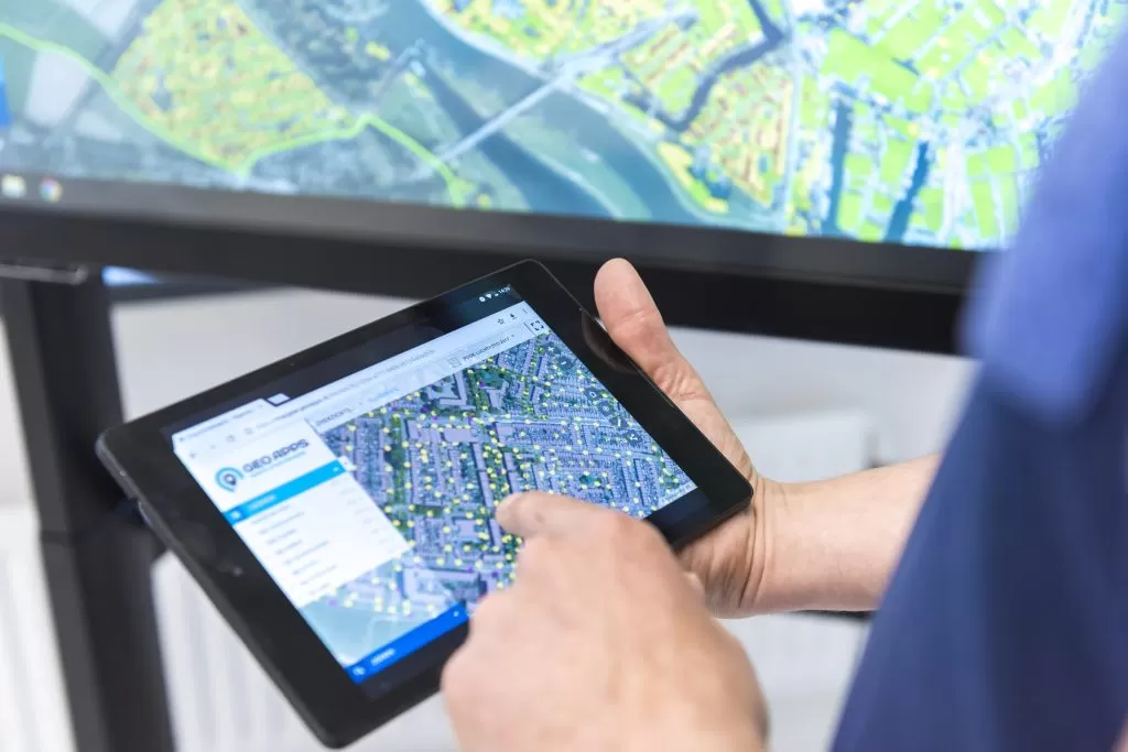
The City of Rotterdam combines neighborhood information in one central mapping environment. With the Wijkatlas built on GeoApps, policymakers and residents gain direct insight and overview.

The City of Rotterdam launched an initiative at the end of 2023 to better understand the specific challenges in each district and neighborhood: the Wijkatlas.
Since maps provide far greater insight than traditional advisory reports, the goal was to adopt a dynamic, map-based approach.
After an initial tender, the project was awarded to GeoApps.
The pilot environment has been successfully used for over a year by more than 120 pilot users.
Insights from this successful pilot were incorporated into a new tender for a full long-term solution.
We’re proud to announce that GeoApps was once again selected as the preferred GIS platform provider for the next five years.
In 2023, the City of Rotterdam started a pilot to map neighborhood-focused challenges more quickly and intelligently.
Where traditional reports often get lost in text, this map-driven approach makes complex information visual, interactive, and actionable.
What began as two separate ideas — the Wijkatlas Rotterdam and the Sustainability Maps 2050 — were combined using GeoApps and datasets from Duurzaamheidskaart, resulting in a simple, unified application.
Through workshops and explainer videos, we helped the municipality adopt the system organization-wide.
As more departments joined and shared their maps, the pilot became a success.
This produced valuable insights into the city’s needs and requirements, such as convenient map-sharing features and overlaying multiple map layers.
Consequently, preparing the tender for the full long-term rollout became much easier.
Until recently, municipal departments worked largely independently with their own datasets and reports — causing fragmentation and slower decision-making.
With nearly 200 map layers spread across 13 themes — from demography and water to climate, underground, and energy — the city now has one central source for spatial information.
This allows policymakers to:
Combine data from multiple themes
Discover new relationships
Generate connected insights — even without GIS expertise
There’s still room for sector-specific deep dives, but now they can be grounded in a shared, integral view of data and challenges.
GeoApps offers a modular, user-friendly 2D and 3D viewer that delivers immediate value without specialized training.
Thanks to smart management maps and integration options with municipal systems, administrators ensure data remains current and manageable.
At the same time, GeoApps is accessible for all as an easy-to-use map viewer across the organization.
One central viewer for all spatial and policy data
Faster decision-making during meetings and project kick-offs
Maps make challenges tangible for all departments
No GIS knowledge required to combine insights
Scalable for any neighborhood and any theme
Departments now collaborate instead of working in isolation
Would you like to know more about this project or how the Wijkatlas and Duurzaamheidskaarten can support your municipality or organization?
Contact us or book a demo at geoapps.nl/en/demo
Laten we bespreken hoe GeoApps uw visie kan helpen realiseren
Onze specialisten denken graag met u mee.