

A Railway Is Drawn on a Map. Its Impact Is Felt at Home.
For the RegioExpres rail project, residents and stakeholders submitted more than 230 responses to proposed designs. See how MapTalk helped bring local concerns, ideas and opportunities directly into the spatial design process.
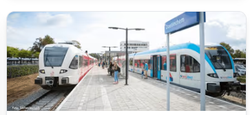
A railway project can look straightforward on a technical drawing: an additional track, a redesigned station, a safer crossing or a new platform. For the people living beside that line, those same changes can affect how they reach their home, what they see from their window, how they move through their neighbourhood and what they experience every day.
That was the challenge surrounding RegioExpres, a major rail project intended to improve connections between Arnhem, Doetinchem and Winterswijk. Making the service possible requires infrastructure changes, including doubling part of the railway between Didam and Doetinchem De Huet and adjustments around stations and crossings. Rather than discussing those plans only after the technical work was complete, the project used MapTalk to bring residents and other stakeholders into the design conversation.
A second track is technical on paper. For residents, it changes the place they live.
Rail design involves engineering requirements, safety standards, environmental studies and operational constraints. Residents experience something different. They see the crossing they use every morning, the path behind their house, the station they walk to or the construction area that could affect their street.
MapTalk helped connect those two perspectives. Participants could explore sketch designs showing proposed railway changes, new platforms, construction areas and crossings, then indicate directly on the map where they saw concerns, opportunities or possible improvements. Instead of separating public feedback from the design, the response remained connected to the location it concerned.
That spatial context matters because “I am concerned about this plan” becomes much more useful when a project team can also see where the concern occurs and which part of the design triggered it.
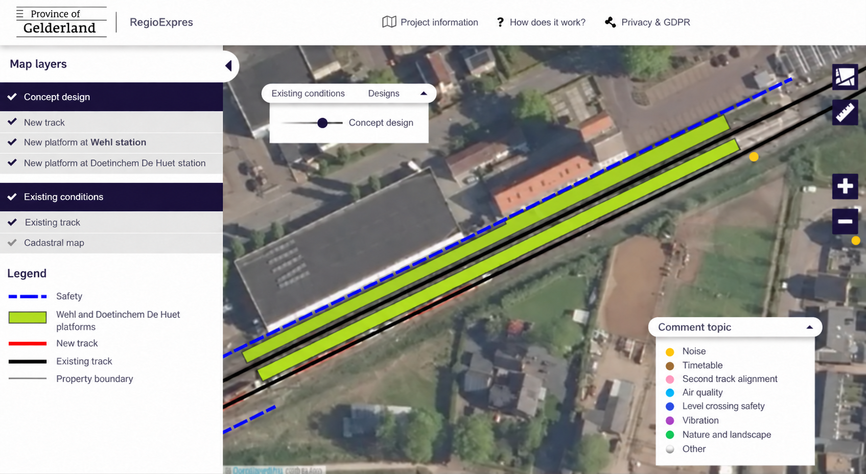
RegioExpres railway concept design with location-based resident feedback topics in MapTalk
231 responses turned one rail corridor into hundreds of local perspectives.
During the consultation period, residents, businesses, social organisations and public authorities submitted more than 231 responses through the MapTalk environment. Those responses included wishes, ideas, concerns and points requiring additional attention around the proposed designs.
The value was not simply the number of comments. Each response added local context to a technically complex infrastructure project. Several people might identify the same crossing. A resident could highlight an issue that was less obvious from a design drawing. Another participant could suggest an opportunity based on years of experience living or travelling through the area.
When those perspectives appear together on the map, participation becomes more than a collection of opinions. It creates a spatial picture of where the project and everyday life meet.
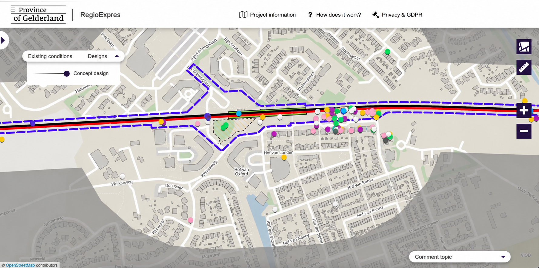
MapTalk map showing location-based responses around the proposed RegioExpres railway design
The strongest design is not only engineered. It is tested against real life.
The RegioExpres involved multiple organisations, including the Province of Gelderland, municipalities, ProRail and transport operators. MapTalk provided a shared environment in which the proposed designs could be viewed alongside feedback from the surrounding area.
That does not mean residents determine every technical decision. Rail infrastructure still has to meet strict engineering, safety and operational requirements. But local knowledge can reveal consequences and opportunities that become easier to understand when they are connected directly to the design.
The wider RegioExpres planning process shows that public input continued to play a role in later design decisions. Province of Gelderland has stated, for example, that participation influenced proposed solutions for particular crossings and station areas.
Participation does not replace engineering expertise. It gives that expertise another layer of reality to work with.
Infrastructure becomes easier to discuss when people can see what will change.
Large infrastructure projects can feel distant when residents are presented with technical reports, drawings and planning documents. Interactive maps make those same plans more tangible by connecting information to the places people already know.
For RegioExpres, that meant turning proposed railway changes into something residents could explore spatially, respond to and discuss while designs were still being developed. The project demonstrates how location-based participation can help infrastructure teams collect structured local knowledge without asking residents to become railway specialists themselves.
The railway may be designed by engineers, but its impact is experienced by everyone living around it. Good participation creates a place for both perspectives.
What could your infrastructure project learn if people could respond directly to the design?
MapTalk helps infrastructure teams present spatial plans clearly, collect location-based feedback and keep stakeholder input connected to the places and design choices it concerns.
Book a demo and see MapTalk in action