

250+ Dangerous Locations in One Day. Residents Already Knew Where the Problems Were.
Omroep Brabant uses MapTalk to map dangerous traffic situations in the province using viewer input.
peeding cars, confusing intersections and streets where cyclists feel squeezed out are often experienced every day long before they appear in an official dataset. Residents already know these places because they walk, cycle and drive through them.
Regional broadcaster Omroep Brabant wanted to turn those individual experiences into something visible. Using MapTalk, people across North Brabant could pinpoint dangerous traffic situations directly on an interactive map, explain what was happening and, where relevant, add a photo. Within the first day alone, residents had already reported more than 250 locations.
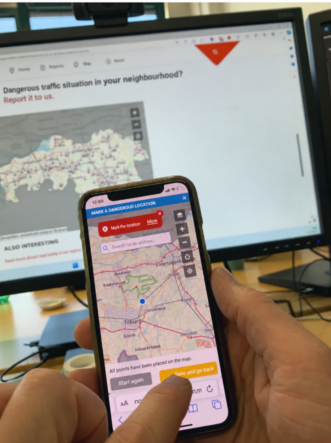
Resident reporting a dangerous traffic location through MapTalk on a mobile phone
One complaint is a story. Hundreds on a map become a pattern.
A comment such as “cars drive too fast here” or “this junction feels unsafe” contains valuable local knowledge, but without a location it can be difficult to interpret or compare with other reports.
MapTalk gave each experience a geographical anchor. Residents could mark the exact location, briefly describe the problem and submit it for review. After approval by Omroep Brabant, reports appeared on the collective map.
That changes the value of the input. Instead of isolated stories scattered across emails, social posts or conversations, recurring concerns become visible together. A street mentioned once may deserve attention. A junction repeatedly identified by different residents can reveal a much stronger signal.
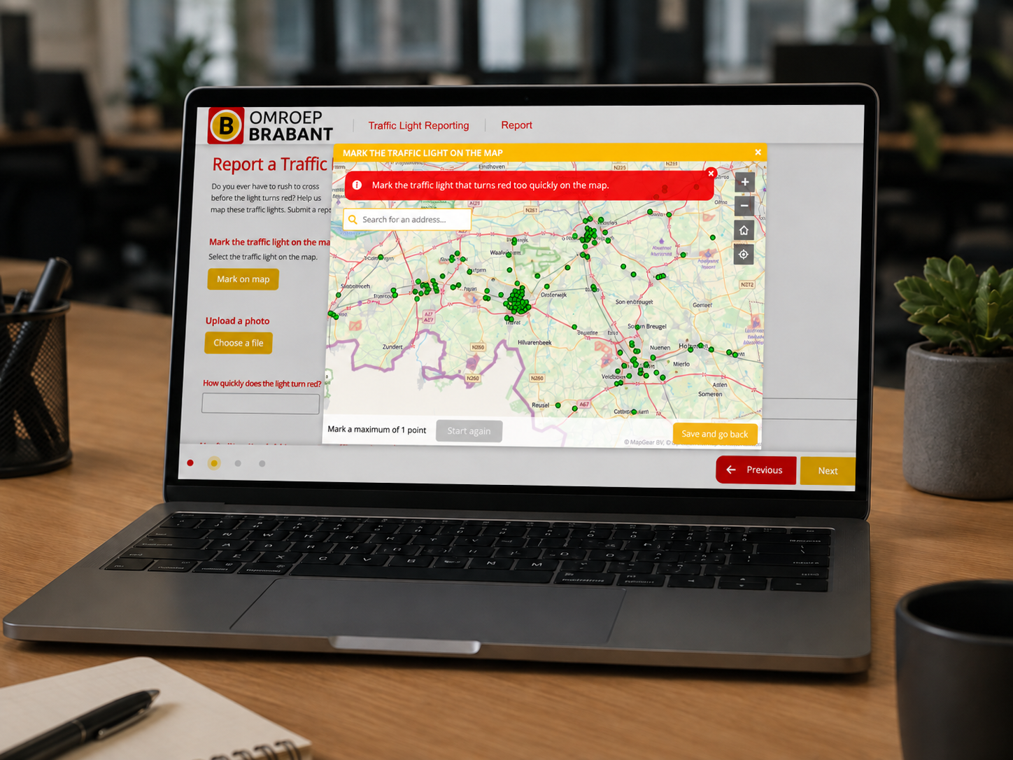
Omroep Brabant MapTalk interface for reporting traffic safety issues on an interactive map
The response showed how much local knowledge was waiting to be heard.
The project gained traction immediately. More than 250 locations were added within just one day, and the map continued to grow as more residents contributed. The current English case description notes that the initiative ultimately produced hundreds of reports.
That rapid response is an important lesson for participation projects. People do not always need lengthy questionnaires or formal consultation sessions to contribute useful information. Sometimes they simply need an accessible way to point to a familiar place and explain what they experience there.
When contributing takes minutes, everyday observations can become valuable spatial evidence.
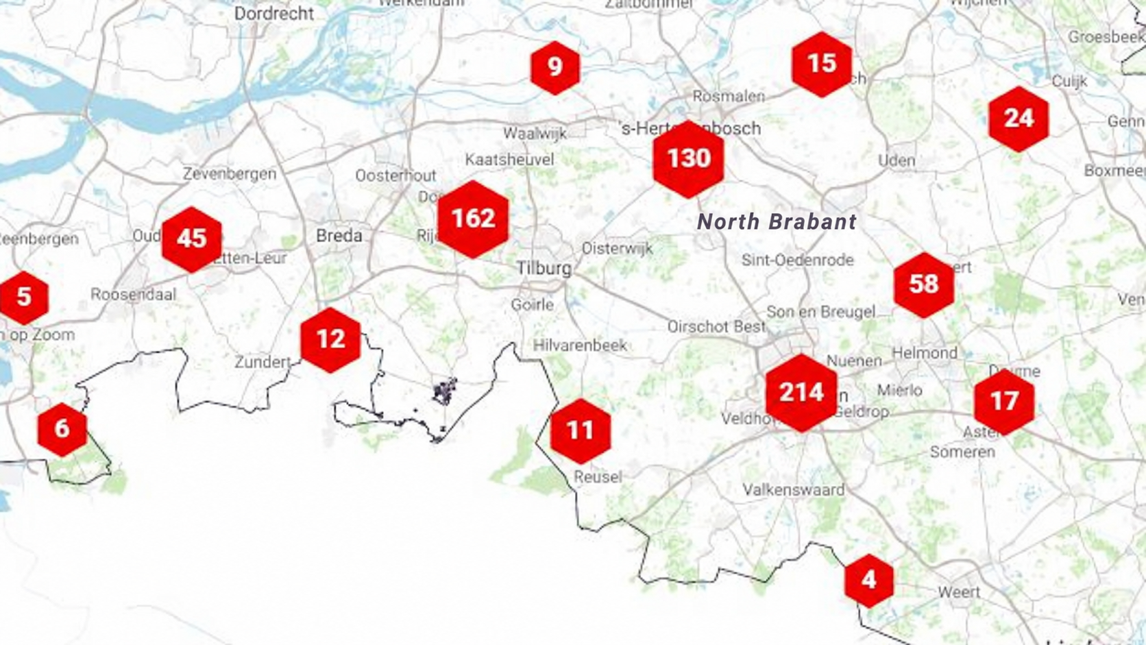
Map showing clusters of reported dangerous traffic locations across North Brabant
Residents identified the problem. The map helped others see the priority.
The information was not collected simply to create a colourful map. Omroep Brabant could use the overview to show where residents were experiencing traffic-safety problems, while the information could also be shared with municipalities and other responsible authorities. The English case study reports that the project led to concrete actions by municipalities to improve traffic safety.
That is where location-based reporting becomes especially powerful. A long list of complaints requires interpretation. A map allows journalists, public authorities and residents to immediately see where reports accumulate and which locations may deserve closer investigation.
The platform does not replace professional traffic analysis, but it can reveal the places where that analysis may need to begin.
Safer streets can start with one resident pointing to one place.
Residents experience infrastructure differently from planners, engineers or traffic models. They know the junction where visibility disappears at rush hour, the street where speeding feels routine or the cycle route where space suddenly becomes uncomfortable.
Omroep Brabant’s project shows how those everyday experiences can be collected at scale without asking residents to become traffic experts. By connecting each report directly to a place, hundreds of individual observations became a shared picture of traffic safety across the region.
People already know where many of the problems are. The challenge is giving them an easy way to put those places on the map.
What could your project uncover if people could simply point to the problem?
MapTalk helps organisations collect structured, location-based feedback and turn individual experiences into spatial insight that is easier to understand, analyse and act on.