

1,200 Responses. One Map. A Clearer Picture of How a Town Moves.
Around 1,200 location-based responses helped reveal how residents experience mobility in Zeewolde. Discover how Keypoint Consultancy combined MapTalk with surveys and stakeholder input to turn local knowledge into practical insights for a long-term mobility plan.
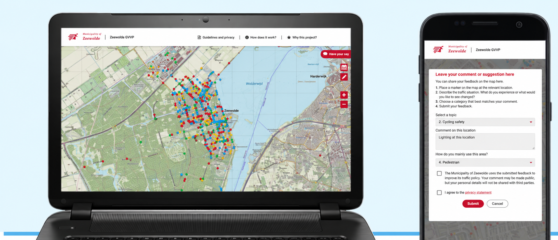
When a municipality plans the next decade of mobility, the people who use its streets every day already know where many of the problems are. The challenge is getting that knowledge out of people’s heads and onto the map.
That was the challenge in Zeewolde, the Netherlands, where Keypoint Consultancy was helping the municipality develop a new Municipal Traffic and Transport Plan for 2021–2030. The plan covered four themes that affect everyday life: accessibility, road safety, liveability and sustainability. Rather than relying only on experts to identify priorities, the project team wanted residents, businesses and other stakeholders to help shape the picture.
People already knew where the problems were. They just needed an easy way to show them.
A traditional questionnaire can reveal what people are concerned about, but mobility problems are inherently spatial. An unsafe cycle crossing, confusing route or parking problem only becomes truly useful to a project team when you know exactly where it happens.
Keypoint therefore combined a broader survey with MapTalk. The survey identified recurring concerns such as route logic, cycle-crossing safety, vehicle speeds and parking. MapTalk then allowed participants to go one step further by pinpointing those issues directly on the map and suggesting possible solutions at the location itself.
Instead of receiving comments such as “cycling here feels unsafe”, the project team could see where that concern applied.
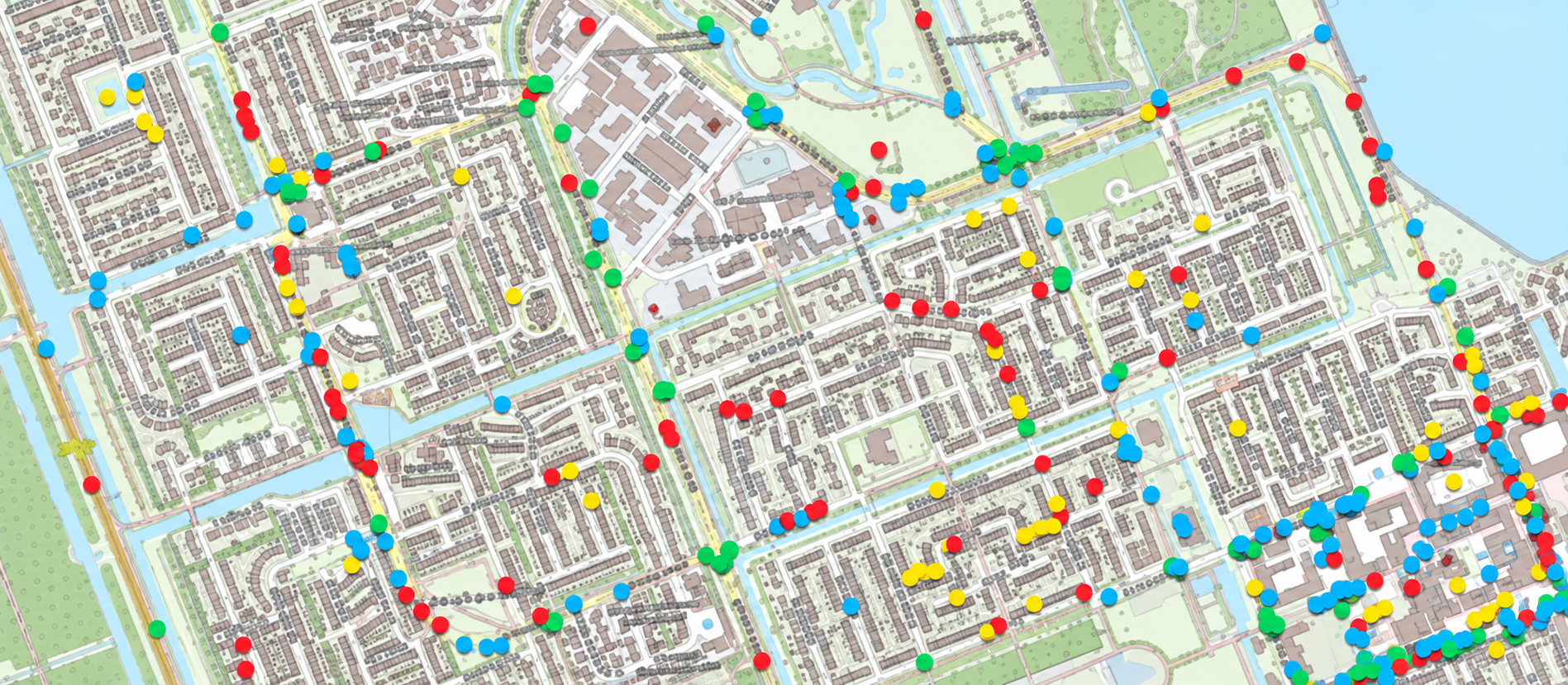
MapTalk map showing hundreds of location-based mobility responses collected from residents in Zeewolde
When participation becomes easier, more local knowledge can surface.
The response was substantial: around 1,200 location-based contributions were submitted through MapTalk. Keypoint described the tool as accessible and easy to use, allowing a large amount of valuable information to be collected within a relatively short period.
That number matters, but the greater value was in the detail behind it. Each response added another piece to the spatial picture of how people actually experienced movement through Zeewolde.
For an international audience, that is the bigger lesson from this project: participation does not always fail because people are unwilling to contribute. Sometimes the barrier is simply how difficult the process makes it to share what they know.
Online participation worked best as part of a bigger conversation.
MapTalk was not used as a replacement for every other participation method. Keypoint combined the interactive map with survey research and input from stakeholder organisations. The consultancy noted that physical meetings can still offer something online tools cannot always provide: deeper, face-to-face conversations around individual concerns.
The strength came from combining approaches. Surveys helped identify broader themes, stakeholder conversations added depth, and MapTalk captured detailed, location-specific knowledge at scale.
The goal was not to move participation online. It was to use the right participation method for the right kind of input.
The plan lasts ten years. The local knowledge can keep adding value.
The Municipal Traffic and Transport Plan establishes the broad direction of Zeewolde’s mobility policy through 2030. But the 1,200 MapTalk responses contain much more detailed information than a strategic plan can accommodate.
That means the value of the participation does not end when the policy document is approved. As specific mobility measures are developed later, the municipality can return to the location-based feedback to understand what residents originally reported at particular streets, crossings and routes.
Good participation does more than support one decision. It creates local knowledge that can remain useful long after the consultation closes.
What could your project learn if residents could simply point to the problem?
MapTalk combines interactive maps, surveys and dashboards so residents and stakeholders can contribute directly to the places that matter, from desktop or mobile.