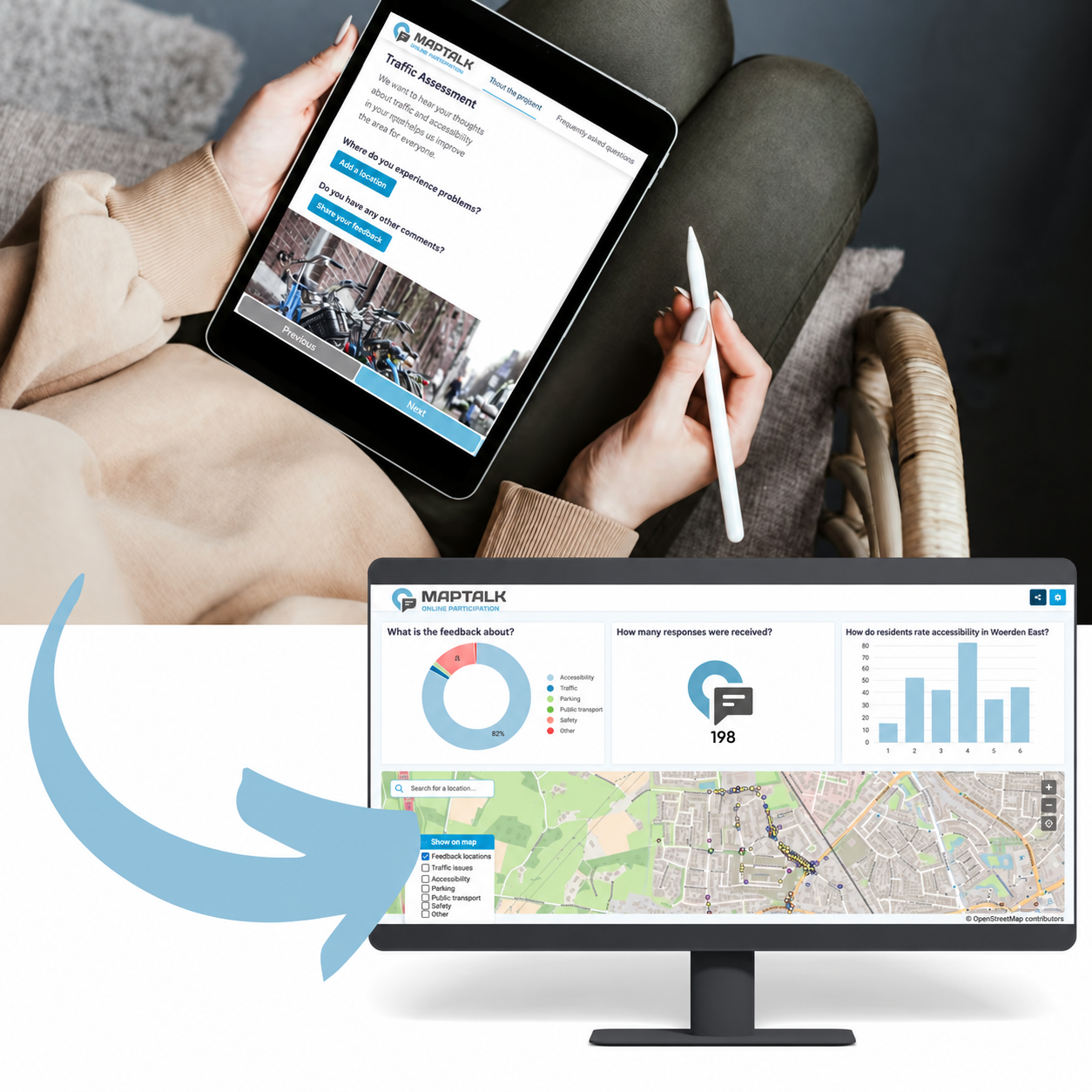
A crossing may look straightforward on a plan, yet feel stressful to the people who use it every day. A cycle route may provide a logical connection while containing an awkward junction or an unclear transition. Traffic counts and spatial analysis help investigate these situations. However, they do not always capture how people experience a place.
Public participation can therefore add valuable context to traffic assessment. By connecting experiences to specific locations, municipalities, transport planners and GIS specialists gain starting points for further investigation. An interactive MapTalk map allows residents to identify where they experience a problem and explain what happens there.
Give Everyday Concerns a Place in Your Assessment
For residents, mobility means everyday activities: cycling to school, buying groceries or crossing the street safely. These repeated experiences can reveal issues that are less apparent in an area-wide analysis.
Start with a clear assessment question. Do you want to understand where cyclists avoid a route, where pedestrians struggle to cross, or which places residents find confusing? A focused question helps participants share relevant information and clarifies which decisions they can influence.
Next, ask about the circumstances. Feedback becomes more informative when someone explains what happens, when it happens and which road users are affected. For example, a comment about a junction may suggest that a site visit or additional observation should take place during the school rush.
Also explain how contributions will be used. Residents should understand whether they are contributing to an initial assessment, a comparison of alternatives or a review of a preliminary design.
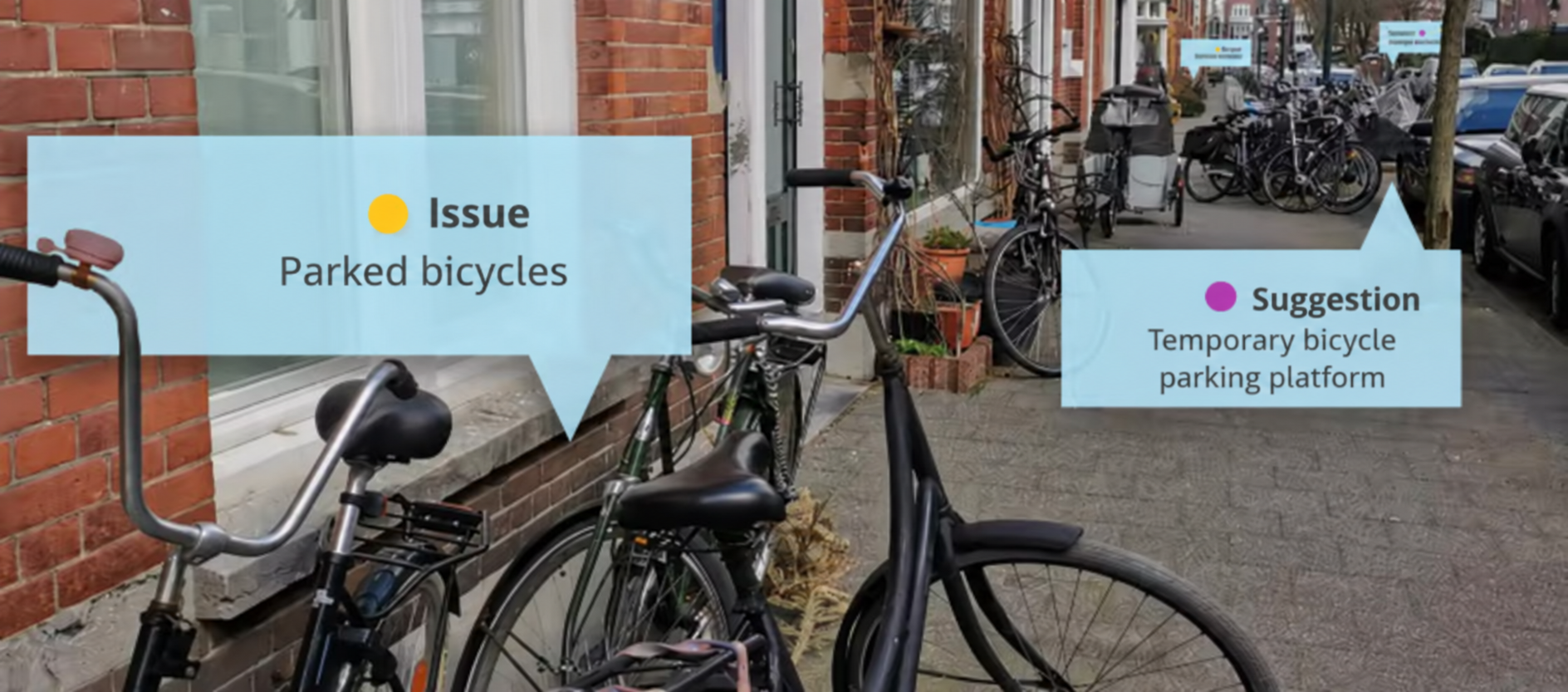
Everyday experiences reveal practical concerns, such as parked bicycles restricting pavement access.
Keep Valuable Experiences Connected to Their Location
A comment such as “this feels unsafe” needs more detail. Does the concern involve speed, limited visibility, insufficient space or unclear priority? And which part of the street does it concern?
Recording feedback on a map preserves its spatial context. With MapTalk, participants can connect their explanation to a place. This gives the assessment team a more precise starting point than a street name in a separate email.
Question design also matters. Use familiar topics while leaving room for participants to explain their experience in their own words. This helps avoid forcing feedback into a category that does not quite fit.
Furthermore, check how precisely locations have been marked. A point in the middle of a junction could refer to several different crossing movements. Before turning a comment into a design requirement, the team may need further clarification.
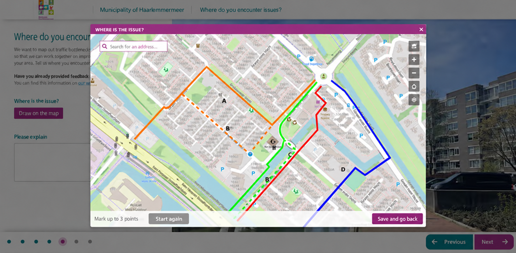
Translated example from Haarlemmermeer: residents connect their feedback to specific locations on an interactive map.
Take Every Concern Seriously Before Drawing Conclusions
Several comments about the same location can justify further investigation. However, they do not automatically prove that it presents the greatest road safety risk. The number of submissions also depends on who saw the invitation, who could participate digitally and which subjects were attracting attention.
Distinguish between comments, participants and traffic assessment findings. One participant may identify several locations. Conversely, a place receiving no comments is not necessarily free of problems. A participation map shows the experiences submitted; it does not, by itself, represent every road user.
For GIS specialists, this raises an important analytical question: which other information can help assess a concern? Depending on availability and suitability, this might include traffic counts, infrastructure characteristics, recorded collisions or observations on site. Keep the source and observation date associated with each dataset.
Together, these sources help shape a more focused investigation. If residents report limited visibility, for example, the team can examine the conditions that may contribute to it. The experience guides the assessment, while the findings require additional expertise and evidence.
Show Residents How Their Feedback Informs Decisions
Participation becomes meaningful when residents can follow what happened to their contribution. Reporting the number of responses alone does not explain which issues were investigated or how decisions were reached.
Organise feedback by location and topic. Then record which concerns were examined, what information was considered and how the options were assessed. Where possible, provide a concrete example linking a reported issue to the assessment findings and any implications for the design.
Not every request can be accommodated. A proposed change may affect other road users, available space or practical feasibility. In these situations, a clear explanation matters. Show which interests were considered and why a particular approach was chosen.
Also combine digital participation with suitable alternatives, such as conversations, meetings or support with submitting feedback. This gives people different ways to share their experiences. The contributions can then be assessed together while preserving the context in which they were collected.
A carefully planned participation process connects local experiences with traffic assessment. The map helps identify where questions arise. Analysis and clear feedback explain what that information means for the next steps.
Would you like to include residents’ experiences in your traffic assessment?