“Des calculs qui nous prenaient une semaine sont maintenant terminés en quelques minutes. Cela nous fait gagner énormément de temps et d’argent.”
Stress thermique & refroidissement cartographiés
Identifiez les zones sensibles à la chaleur et développez des mesures de refroidissement efficaces. Protégez les habitants contre les risques sanitaires du stress thermique urbain grâce à des insights fondés sur les données.
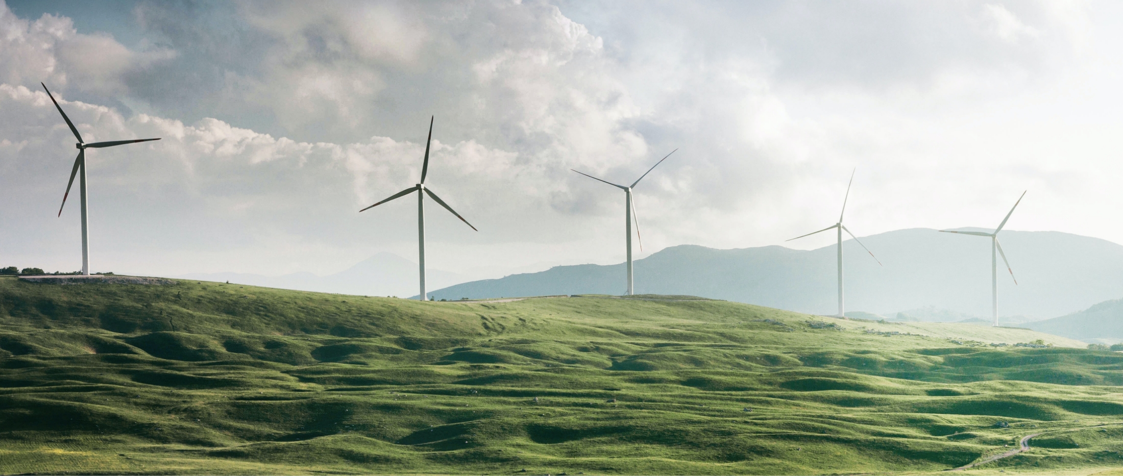
Les îlots de chaleur urbains menacent la santé des habitants, en particulier les personnes âgées et celles atteintes de maladies chroniques. Le stress thermique urbain n'est pas seulement inconfortable, il peut être mortel. La visibilité sur le refroidissement, l'ombre et le vert aide à prendre des mesures efficaces.
Santé
Limiter les risques
Refroidissement
Distance au frais
Politique
Planification du refroidissement
Habitants
Protection
Les responsables politiques analysent le stress thermique avec des cartes de distance au refroidissement, d'ombre sur les itinéraires piétons et de vert par quartier. Voyez où les mesures ont le plus grand effet.
Rassemblez îlots de chaleur, ombre, groupes vulnérables et lieux frais. Priorisez les mesures et rendez la politique de chaleur compréhensible.
Demander une démo
“En 2020, 20 000 Européens sont morts du stress thermique. Sans action, ce chiffre doublera d'ici 2050.”
+15%
Plus d'hospitalisations
Risques sanitaires
Amsterdam
Jusqu'à 8°C plus chaud
Urbanisation
2023
Année la plus chaude jamais enregistrée
Changement climatique
Les villes se réchauffent en raison du changement climatique et de l'urbanisation. Les îlots de chaleur menacent la santé des habitants, en particulier les personnes âgées et celles atteintes de maladies chroniques.
Les îlots de chaleur provoquent des problèmes de santé tels que coups de chaleur, déshydratation et aggravation de maladies chroniques.
Les surfaces en béton absorbent et retiennent la chaleur, rendant les zones urbaines plus chaudes que la nature environnante.
Des conditions météorologiques plus extrêmes rendent les vagues de chaleur plus fréquentes et intenses, avec des risques sanitaires accrus.
Une boîte à outils complète pour les municipalités qui prennent au sérieux le stress thermique. De l'analyse à l'action : des résultats mesurables pour une ville plus fraîche et plus saine.
Identification détaillée des zones sensibles à la chaleur avec mesures de température et analyse des risques.
Quantification des effets de refroidissement du vert, de l'eau et des dispositifs d'ombre.
Base de données de mesures de refroidissement éprouvées et stratégies de mise en œuvre.
Évaluation des risques sanitaires et de l'efficacité des mesures préventives.
Page actuelle
Insight Stress thermique est intégré de manière transparente à la plateforme DZHK, avec toutes vos autres données de durabilité pour une vue d'ensemble complète de l'adaptation climatique.
Insight Stress thermique
Expériences d’organisations qui travaillent avec DZHK.
“Des calculs qui nous prenaient une semaine sont maintenant terminés en quelques minutes. Cela nous fait gagner énormément de temps et d’argent.”

“Nous ne présentons plus notre expertise sous forme de rapports austères, mais d’applications cartographiques interactives. Même les personnes sans connaissances techniques peuvent les utiliser, ce qui fait de DZHK une base essentielle pour l’élaboration des politiques.”

“DZHK nous a aidés à rendre les données de durabilité accessibles à tous. La plateforme allie une visualisation puissante à une expérience utilisateur simple.”
“Avec MapGear (DZHK), nous avons établi une prévision réaliste du potentiel solaire à Groningen pour 2035. Nous combinons des données sur les toitures, les pompes à chaleur, la mobilité électrique et les choix politiques pour une vision fiable de l’avenir.”

“Avec MapGear (DZHK), nous avons développé le TransitiePlanner. Il nous permet de collecter, analyser et visualiser des données sur la consommation d’énergie, l’adaptation climatique et la mobilité durable. Nous constituons un dossier dynamique pour les zones d’activités durables.”

“DZHK nous a aidés à planifier et réaliser nos projets de transition énergétique plus efficacement.”

“Avec Asbestdakenkaart, nous avons enfin une vue d’ensemble de nos données amiante et de l’avancement des travaux de désamiantage. Un seul endroit pour prioriser, suivre et rendre compte.”
“Des calculs qui nous prenaient une semaine sont maintenant terminés en quelques minutes. Cela nous fait gagner énormément de temps et d’argent.”
“Nous ne présentons plus notre expertise sous forme de rapports austères, mais d’applications cartographiques interactives. Même les personnes sans connaissances techniques peuvent les utiliser, ce qui fait de DZHK une base essentielle pour l’élaboration des politiques.”
“DZHK nous a aidés à rendre les données de durabilité accessibles à tous. La plateforme allie une visualisation puissante à une expérience utilisateur simple.”
“Avec MapGear (DZHK), nous avons établi une prévision réaliste du potentiel solaire à Groningen pour 2035. Nous combinons des données sur les toitures, les pompes à chaleur, la mobilité électrique et les choix politiques pour une vision fiable de l’avenir.”
“Avec MapGear (DZHK), nous avons développé le TransitiePlanner. Il nous permet de collecter, analyser et visualiser des données sur la consommation d’énergie, l’adaptation climatique et la mobilité durable. Nous constituons un dossier dynamique pour les zones d’activités durables.”
“DZHK nous a aidés à planifier et réaliser nos projets de transition énergétique plus efficacement.”
“Avec Asbestdakenkaart, nous avons enfin une vue d’ensemble de nos données amiante et de l’avancement des travaux de désamiantage. Un seul endroit pour prioriser, suivre et rendre compte.”
Demandez une démo pour la planification du refroidissement et l'analyse du stress thermique sur vos données.
Réponses aux questions les plus fréquentes sur Insight Stress thermique.
La confiance des communes, provinces et organisations aux Pays-Bas et en Belgique


Vous voulez savoir ce que nous pouvons faire pour votre organisation ? Contactez-nous pour une démo sans engagement. Besoins particuliers ? Laissez vos coordonnées ci-dessous.