“Berekeningen waarvoor we vroeger een week nodig hadden, zijn nu in enkele minuten klaar. Dat bespaart ons enorm veel tijd én geld.”
Engagement, suivi & reporting
Impliquez habitants et parties prenantes dans l'adaptation climatique. Suivez initiatives et progression, et communiquez clairement à l'administration, au conseil ou aux habitants. L'outil soutient municipalités et provinces dans l'engagement, le suivi et le reporting : pas un visualiseur de risques séparé, mais une plateforme pour travailler ensemble à l'adaptation climatique.
Chaleur, sécheresse et inondations touchent directement les habitants. L'adaptation climatique ne réussit que si vous impliquez habitants et parties prenantes, suivez les initiatives et communiquez clairement la progression.
Engagement
Impliquer les parties prenantes
Suivi
Initiatives & progression
Communication
Administration & habitants
Reporting
Redevabilité
Les responsables politiques et décideurs voient initiatives, mesures et progression dans une seule vue d'ensemble. Filtrez par thème, zone ou statut, exportez pour les rapports et présentez clairement au conseil ou aux habitants.
Inondations, sécheresse, chaleur et risque de crue se retrouvent sur une carte exploitable. Surveillez la vulnérabilité et suivez les mesures dans le temps.
Demander une démo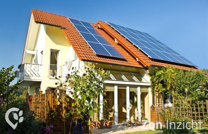
Chaleur, sécheresse et inondations touchent directement les habitants. L'adaptation climatique ne réussit que si vous impliquez habitants et parties prenantes, suivez les initiatives et communiquez clairement la progression. Pas de cartes de risques séparées, mais une plateforme pour travailler ensemble à l'adaptation climatique.
Impliquez administration, conseil et habitants dans l'adaptation climatique. Présentez initiatives, résultats et progression de manière compréhensible.
Suivez initiatives, mesures et progression. Rapportez clairement à l'administration et aux organes de redevabilité.
Cartes, tableaux de bord et rapports pour le pilotage interne et la communication externe. Alignement avec le test de résilience et le programme Delta.
Impliquez les parties prenantes, suivez les initiatives et communiquez la progression. Pas un visualiseur de risques séparé, mais un outil pour travailler ensemble à l'adaptation climatique.
Présentez initiatives et résultats sur cartes et tableaux de bord. Rendez l'adaptation climatique accessible à l'administration, au conseil et aux habitants.
Suivez mesures, projets et progression. Rapportez à l'administration et aux organes de redevabilité.
Cartes, tableaux de bord et rapports pour le pilotage interne et la communication externe. Alignement avec le test de résilience et le programme Delta.
Analyse de données, mesures, vision spatiale, test de résilience et participation : tout pour l'adaptation climatique dans un seul environnement.
Intégrez l'adaptation climatique dans les plans d'urbanisme et l'aménagement du territoire. Impliquez les parties prenantes et communiquez la progression.
Alignez-vous sur le test de résilience climatique et le programme Delta. Suivez la progression et rapportez aux organes de redevabilité.
Impliquez les habitants dans l'adaptation climatique. Informez sur les initiatives, collectez les retours et construisez le soutien.
Page actuelle
Le Moniteur d'adaptation climatique est intégré de manière transparente à la plateforme DZHK, avec toutes vos autres données de durabilité.
Moniteur d'adaptation climatique
Expériences d'organisations qui travaillent avec DZHK.
“Berekeningen waarvoor we vroeger een week nodig hadden, zijn nu in enkele minuten klaar. Dat bespaart ons enorm veel tijd én geld.”

“We presenteren onze expertise niet meer als saaie rapporten, maar als interactieve kaartapplicaties. Zelfs mensen zonder technische kennis kunnen er gebruik van maken, wat Duurzaamheidskaart tot een essentiële basis maakt voor beleidsvorming.”

“Duurzaamheidskaart heeft ons geholpen om duurzaamheidsdata toegankelijk te maken voor iedereen. Het platform combineert krachtige visualisatie met eenvoudige gebruikerservaring.”
“Samen met MapGear (Duurzaamheidskaart) konden we een realistische prognose maken van de zonnepotentie in Groningen in 2035. We combineren data over daken, warmtepompen, elektrisch rijden en beleidskeuzes voor een betrouwbaar toekomstbeeld.”
“Samen met MapGear (Duurzaamheidskaart) ontwikkelden we de TransitiePlanner. Deze stelt ons in staat data te verzamelen, analyseren en visualiseren over energieverbruik, klimaatadaptatie en duurzame mobiliteit. We bouwen een dynamisch dossier op voor duurzame bedrijventerreinen.”
“De duurzaamheidskaart heeft ons geholpen om onze energietransitieprojecten efficiënter te plannen en uit te voeren.”

“Met Asbestdakenkaart hebben we voor het eerst overzicht op onze asbestdata en saneringsvoortgang. Eén plek om te prioriteren, monitoren en rapporteren.”
“Berekeningen waarvoor we vroeger een week nodig hadden, zijn nu in enkele minuten klaar. Dat bespaart ons enorm veel tijd én geld.”
“We presenteren onze expertise niet meer als saaie rapporten, maar als interactieve kaartapplicaties. Zelfs mensen zonder technische kennis kunnen er gebruik van maken, wat Duurzaamheidskaart tot een essentiële basis maakt voor beleidsvorming.”
“Duurzaamheidskaart heeft ons geholpen om duurzaamheidsdata toegankelijk te maken voor iedereen. Het platform combineert krachtige visualisatie met eenvoudige gebruikerservaring.”
“Samen met MapGear (Duurzaamheidskaart) konden we een realistische prognose maken van de zonnepotentie in Groningen in 2035. We combineren data over daken, warmtepompen, elektrisch rijden en beleidskeuzes voor een betrouwbaar toekomstbeeld.”
“Samen met MapGear (Duurzaamheidskaart) ontwikkelden we de TransitiePlanner. Deze stelt ons in staat data te verzamelen, analyseren en visualiseren over energieverbruik, klimaatadaptatie en duurzame mobiliteit. We bouwen een dynamisch dossier op voor duurzame bedrijventerreinen.”
“De duurzaamheidskaart heeft ons geholpen om onze energietransitieprojecten efficiënter te plannen en uit te voeren.”
“Met Asbestdakenkaart hebben we voor het eerst overzicht op onze asbestdata en saneringsvoortgang. Eén plek om te prioriteren, monitoren en rapporteren.”
Demandez une démo sans engagement ou un devis sur mesure. Nous vous conseillons volontiers sur l'engagement, le suivi et le reporting pour votre organisation.
Réponses sur l'engagement et le suivi de l'adaptation climatique.
La confiance des communes, provinces et organisations aux Pays-Bas et en Belgique


Vous voulez savoir ce que nous pouvons faire pour votre organisation ? Contactez-nous pour une démo sans engagement. Besoins particuliers ? Laissez vos coordonnées ci-dessous.