

Arup Turns 948 Map-Based Responses into Bicycle Parking Priorities in The Hague
The City of The Hague asked Arup to identify where bicycle parking was causing the greatest problems in two compact neighbourhoods. Using MapTalk, residents and local businesses submitted 948 location-based responses, which Arup combined with technical data to identify priority locations and develop design options.
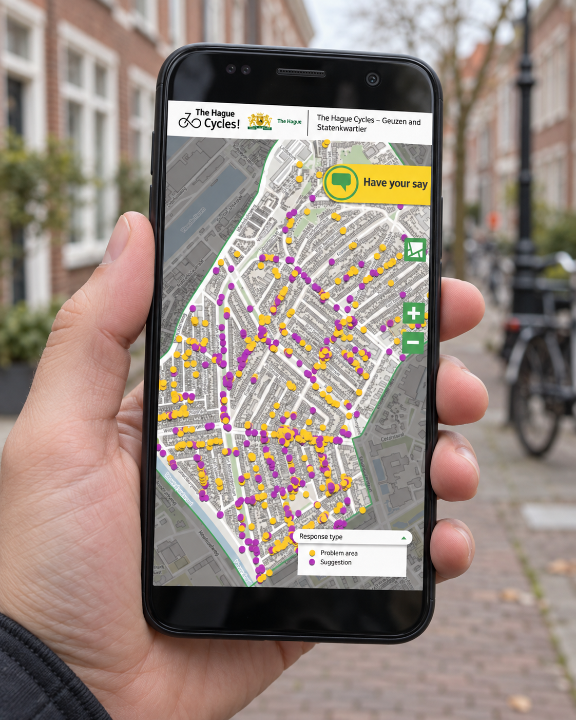
In the compact Geuzen- and Statenkwartier neighbourhoods of The Hague, parked bicycles were taking up valuable pavement space. Limited indoor bicycle storage meant that many bicycles ended up outside, while abandoned bicycles added further pressure. For residents using mobility aids, parents with pushchairs and other pedestrians, the issue was therefore about much more than bicycle parking. It was also about keeping the street accessible.
The City of The Hague commissioned engineering and design consultancy Arup to work with residents and local businesses to identify the most serious problem locations and explore possible solutions. The project formed part of the municipality’s “Ruim baan voor de fiets” implementation programme, which can be translated as “More Room for Cycling”, aimed at improving cycling conditions and bicycle parking across the city.
Instead of asking people to describe the problem in general terms, Arup used MapTalk to let participants point directly to the places where bicycle parking caused difficulties and suggest what could improve those locations.
When bicycles block the pavement, the problem becomes about accessibility too
The neighbourhoods involved were built before widespread car and bicycle ownership, and their compact streets leave limited space for storing bicycles indoors. As a result, pavements can become crowded with parked bikes, while abandoned bicycles may remain in public space for long periods.
To understand where these problems were most severe, Arup and the municipality invited residents to share their experience through an interactive MapTalk map. The application worked on both desktop and mobile devices, allowing participants to select a specific location and explain where they experienced problems or wanted to see an improvement.
This geographic context was important. Rather than receiving only comments such as “there are too many bicycles here,” the project team could see the street, junction or section of pavement the participant was actually referring to.
948 mapped responses turned individual complaints into visible patterns
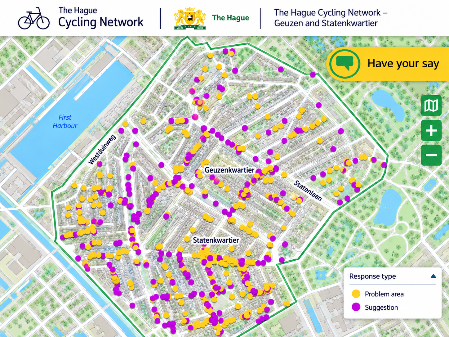
The participation process generated 948 responses. Because each contribution could be connected to a location, Arup could see where problems repeatedly appeared and compare experiences across the two neighbourhoods.
The responses were then analysed alongside objective information, including bicycle counts and locations where abandoned bicycles were regularly removed. By combining those sources, Arup established a top 20 of the most serious problem locations.
This made the participation data more useful than a standalone survey. The map showed where local experience reinforced patterns already visible in technical data and where residents highlighted problems that numbers alone might not explain.
Technical data showed the pressure. Residents explained what the street actually needed.
The mapped responses also revealed that the solution was not always simply “add more bicycle parking.” Some bicycle racks were consistently overloaded while others were barely used, and residents suggested a wider range of improvements. These included broader pavements, better lighting, additional green space and more logical pedestrian and cycling routes.
Consequently, Arup could use local experience alongside technical analysis rather than treating participation as a separate communications exercise. The resident input helped explain how infrastructure was experienced in everyday life, while the objective datasets helped the project team assess the scale and location of the problem.
Together, those perspectives provided a stronger basis for developing the first design proposals.
Residents did not only identify the problems. They helped decide what came first.
After the initial responses had been analysed, residents were involved again. At a community meeting, participants voted on which locations should be addressed first, reducing the initial top 20 problem areas to a top 10 priority list for further work.
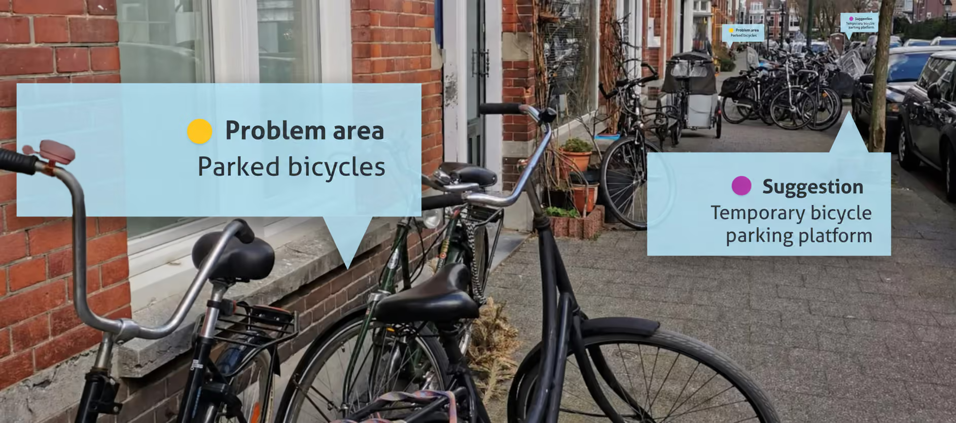
Arup then developed different design options around those priorities. Potential measures included additional bicycle stands, covered bicycle parking and temporary bicycle-parking platforms that can use space normally occupied by a car parking bay. The consultancy also compiled examples of bicycle-parking solutions already used by other Dutch municipalities to support the design process.
The case shows how participation can contribute directly to technical planning. For Arup, location-based input strengthened the evidence behind its design choices. For the municipality, it reduced the need to rely only on assumptions about where problems were most severe. And for residents, their everyday experience became visible within the process that determined which locations would receive further attention.
Rather than collecting feedback after a solution had already been designed, the project used resident knowledge to help identify the problems, rank the priorities and inform the design options.
What could your mobility project learn if residents could point directly to the place where the problem occurs?
MapTalk helps municipalities and consultancies collect structured, location-based feedback and combine local experience with professional spatial analysis.
See how MapTalk can support your next mobility or infrastructure project